National Geographic
Desolation, Granite Chief Wilderness: Map #802
Desolation, Granite Chief Wilderness: Map #802
Couldn't load pickup availability
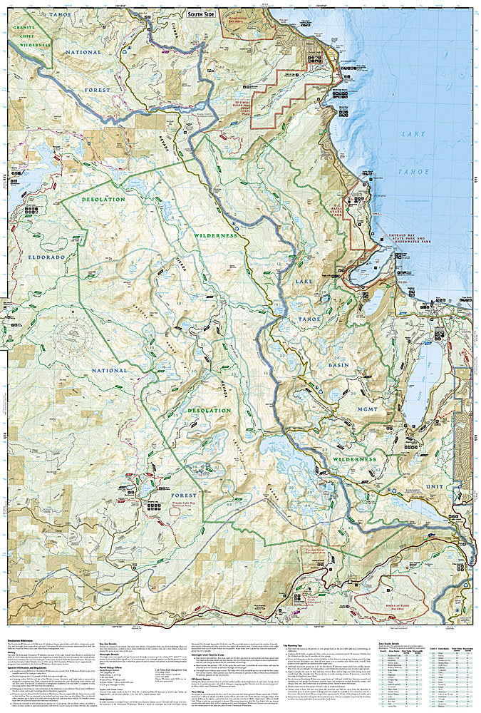
National Geographic Trails Illustrated Desolation & Granite Chief Wilderness Map #802 — waterproof, tear-resistant. Coverage of the Desolation Wilderness, Granite Chief Wilderness, Pacific Crest Trail corridor, and surrounding Lake Tahoe Basin terrain in California. GPS-compatible.
The National Geographic Trails Illustrated Desolation & Granite Chief Wilderness Map covers the Desolation Wilderness — the most heavily used wilderness area per acre in the US — and the Granite Chief Wilderness near Lake Tahoe. The PCT corridor, granite lake basins, permit zone boundaries, trailheads, and GPS coordinates are mapped in detail.
Key specs
- SKU: NGTI802
- Map number: 802
- Coverage: Desolation & Granite Chief Wilderness, California (Lake Tahoe area)
- Material: Waterproof, tear-resistant paper
- Features: Trails, PCT corridor, granite lake basins, permit zone boundaries, trailheads, GPS coordinates
Why it works
The Desolation Wilderness requires a permit for overnight use and has strict quota zones — accurate permit zone boundary mapping is essential for planning compliant backcountry trips. The dense network of granite lake basins requires detailed mapping to navigate between them efficiently. Waterproof construction survives the Sierra Nevada's afternoon thunderstorms and the snowpack that can linger into early summer at higher elevations.
Ideal for
Backpackers, PCT hikers, and day hikers exploring the Desolation and Granite Chief Wilderness areas near Lake Tahoe. See also NGTI1013 (Tahoe Rim Trail) for the full lake circumnavigation route.
Share