National Geographic
Yampa, Gore Pass: Map #119
Yampa, Gore Pass: Map #119
Couldn't load pickup availability
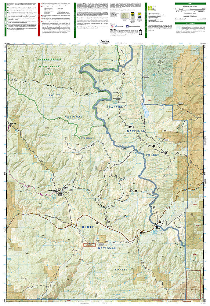
National Geographic Trails Illustrated Yampa & Gore Pass Map #119 — waterproof, tear-resistant, scale 1:63,360. Coverage of the Yampa River headwaters, Gore Pass, Sarvis Creek Wilderness, and surrounding Routt National Forest in northwestern Colorado. GPS-compatible.
The National Geographic Trails Illustrated Yampa & Gore Pass Map covers the Yampa River headwaters and Gore Pass corridor in northwestern Colorado — the Sarvis Creek Wilderness, Gore Pass, and surrounding Routt National Forest. Hiking and equestrian trails, wilderness boundaries, fishing access, campgrounds, and GPS coordinates are mapped in detail.
Key specs
- SKU: NGTI119
- Map number: 119
- Scale: 1:63,360
- Coverage: Yampa & Gore Pass area, Routt National Forest, Colorado
- Material: Waterproof, tear-resistant paper
- Features: Trails, Sarvis Creek Wilderness, Yampa River headwaters, Gore Pass, fishing access, GPS coordinates
Why it works
The Yampa River headwaters and Sarvis Creek Wilderness offer remote hiking and fishing terrain between Steamboat Springs and Kremmling that sees far fewer visitors than the more popular areas to the north and south — accurate trail and wilderness boundary mapping is essential for navigation in this less-traveled terrain. Gore Pass provides a historic crossing of the Gore Range. Waterproof construction survives the variable weather common in northwestern Colorado's mountain terrain.
Ideal for
Hunters, hikers, anglers, and equestrians exploring the Yampa River headwaters, Sarvis Creek Wilderness, and Gore Pass area in Routt National Forest. See also NGTI118 (Steamboat Springs, Rabbit Ears) for adjacent coverage to the north.
Share