National Geographic
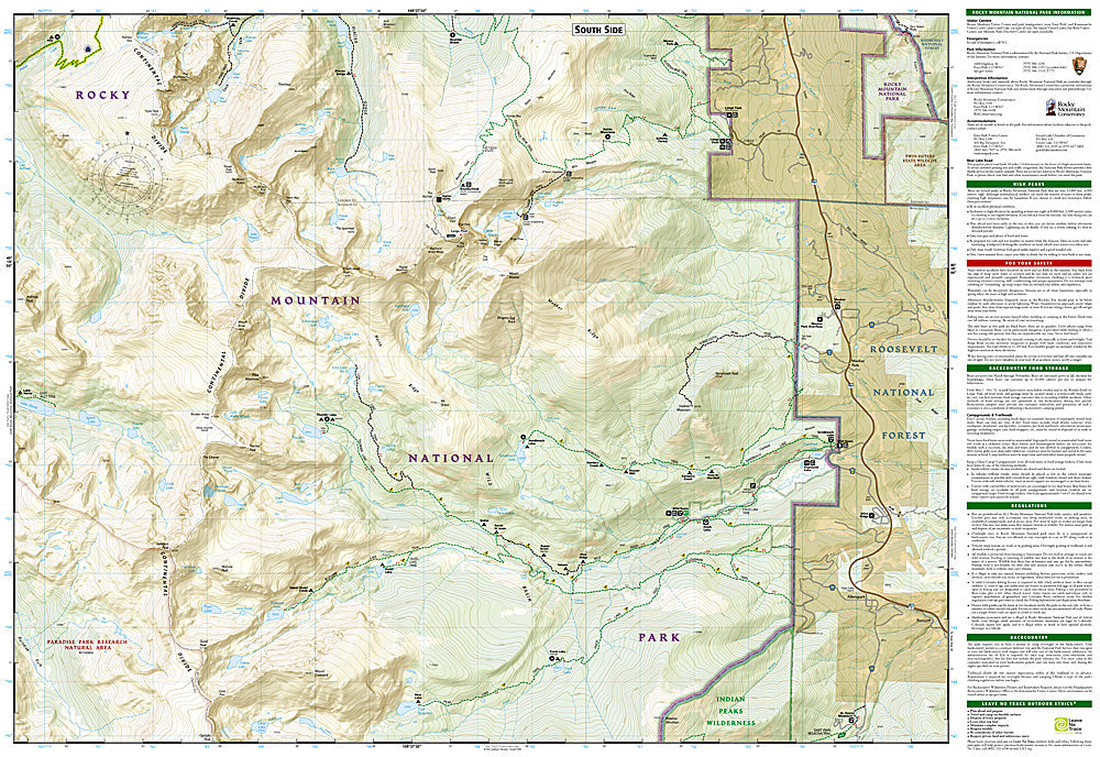
Longs Peak, Bear Lake: Map #301
Longs Peak, Bear Lake: Map #301
Couldn't load pickup availability
National Geographic Trails Illustrated Longs Peak & Bear Lake Map #301 — waterproof, tear-resistant. Coverage of the Longs Peak area, Bear Lake corridor, Wild Basin, and surrounding Rocky Mountain National Park terrain in Colorado. GPS-compatible.
The National Geographic Trails Illustrated Longs Peak & Bear Lake Map covers the most popular section of Rocky Mountain National Park — Longs Peak (14,259 ft, the only 14er in RMNP), the Bear Lake corridor (the park's most visited trail network), Wild Basin, and the Keyhole Route on Longs Peak. Trails, climbing routes, backcountry campsites, wilderness boundaries, and GPS coordinates are mapped in detail.
Key specs
- SKU: NGTI301
- Map number: 301
- Coverage: Longs Peak & Bear Lake area, Rocky Mountain National Park, Colorado
- Material: Waterproof, tear-resistant paper
- Features: Trails, Longs Peak Keyhole Route, Bear Lake corridor, Wild Basin, backcountry campsites, GPS coordinates
Why it works
Longs Peak is one of the most climbed 14ers in Colorado and the only one in Rocky Mountain National Park — the Keyhole Route's above-treeline terrain and the technical sections above the Keyhole require accurate route and terrain detail for safe navigation. The Bear Lake corridor's timed entry permit system and the park's complex trail network require detailed trailhead and junction mapping. Waterproof construction survives RMNP's afternoon thunderstorms and the variable weather common on Longs Peak's exposed summit.
Ideal for
Hikers, mountaineers, backpackers, and park visitors exploring Longs Peak, the Bear Lake corridor, and Wild Basin in Rocky Mountain National Park. See also NGTI200 (Rocky Mountain National Park) for full park coverage.
Share