National Geographic
Indian Peaks & Gold Hill: Map #102
Indian Peaks & Gold Hill: Map #102
Couldn't load pickup availability
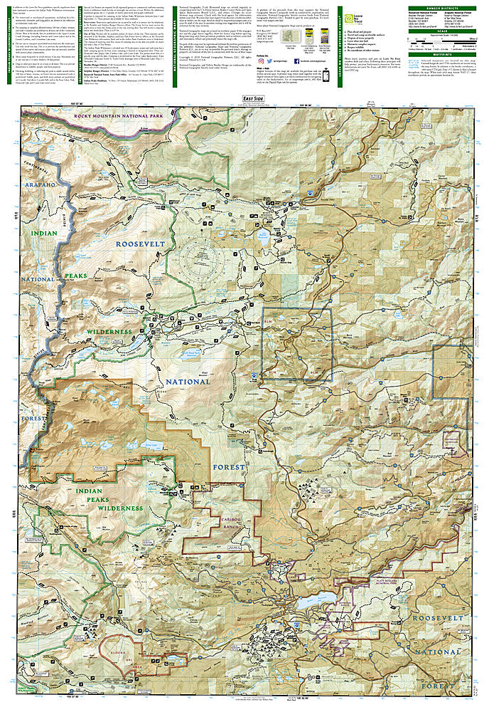
National Geographic Trails Illustrated Indian Peaks & Gold Hill Map #102 — waterproof, tear-resistant, scale 1:40,000. Coverage of the Indian Peaks Wilderness, Brainard Lake Recreation Area, and surrounding Roosevelt National Forest west of Boulder, Colorado. GPS-compatible.
The National Geographic Trails Illustrated Indian Peaks & Gold Hill Map covers the Indian Peaks Wilderness and surrounding terrain west of Boulder — the Brainard Lake Recreation Area, Fourth of July trailhead, Arapaho Glacier, and the Gold Hill mining district. Trails, wilderness boundaries, alpine lakes, climbing routes, trailheads, and GPS coordinates are mapped in detail.
Key specs
- SKU: NGTI102
- Map number: 102
- Scale: 1:40,000
- Coverage: Indian Peaks Wilderness & Gold Hill area, Colorado
- Material: Waterproof, tear-resistant paper
- Features: Trails, Indian Peaks Wilderness, Brainard Lake, Arapaho Glacier, climbing routes, GPS coordinates
Why it works
The Indian Peaks Wilderness is the most heavily used wilderness area in Colorado, with the Brainard Lake Recreation Area serving as the primary access point for hikers from Boulder and Denver — detailed trail and lake mapping is essential for navigating the wilderness's dense network of routes efficiently. The Arapaho Glacier is one of the southernmost glaciers in the US and a significant mountaineering objective. Waterproof construction survives the Front Range's afternoon thunderstorms that are a constant hazard on the exposed Indian Peaks ridgeline.
Ideal for
Hikers, backpackers, climbers, and outdoor enthusiasts exploring the Indian Peaks Wilderness and Brainard Lake area west of Boulder. See also NGTI103 (Winter Park, Central City) for adjacent coverage to the south.
Share