National Geographic
Gunnison, Pitkin: Map #132
Gunnison, Pitkin: Map #132
Couldn't load pickup availability
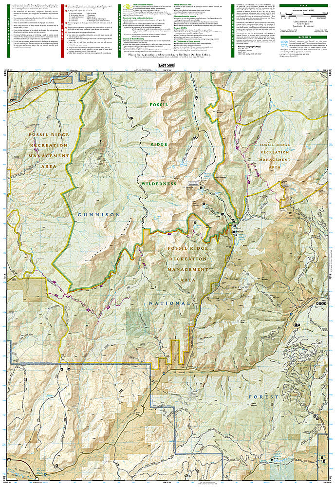
National Geographic Trails Illustrated Gunnison & Pitkin Map #132 — waterproof, tear-resistant, scale 1:63,360. Coverage of the Gunnison area, Pitkin, Alpine Tunnel, Cumberland Pass, and surrounding Gunnison National Forest in Colorado. GPS-compatible.
The National Geographic Trails Illustrated Gunnison & Pitkin Map covers the Gunnison area and surrounding Gunnison National Forest — the historic Alpine Tunnel (one of the highest railroad tunnels ever built), Cumberland Pass, Pitkin, and surrounding forest terrain. Trails, OHV routes, historic sites, campgrounds, and GPS coordinates are mapped in detail.
Key specs
- SKU: NGTI132
- Map number: 132
- Scale: 1:63,360
- Coverage: Gunnison & Pitkin area, Gunnison National Forest, Colorado
- Material: Waterproof, tear-resistant paper
- Features: Trails, Alpine Tunnel, Cumberland Pass, OHV routes, historic sites, campgrounds, GPS coordinates
Why it works
The Alpine Tunnel and Cumberland Pass area is one of Colorado's most historically significant and scenically spectacular OHV destinations, with the tunnel's ruins and the high-altitude pass road attracting history enthusiasts and outdoor recreationists alike — detailed OHV route and historic site mapping is essential for navigating the complex forest road network. Waterproof construction survives the Gunnison area's variable weather and the high-altitude afternoon thunderstorms common in summer.
Ideal for
OHV riders, history enthusiasts, hikers, and outdoor explorers visiting the Alpine Tunnel, Cumberland Pass, and Gunnison National Forest near Pitkin, Colorado. See also NGTI131 (Crested Butte, Pearl Pass) for adjacent coverage to the north.
Share