National Geographic
Grand Mesa: Map #136
Grand Mesa: Map #136
Couldn't load pickup availability
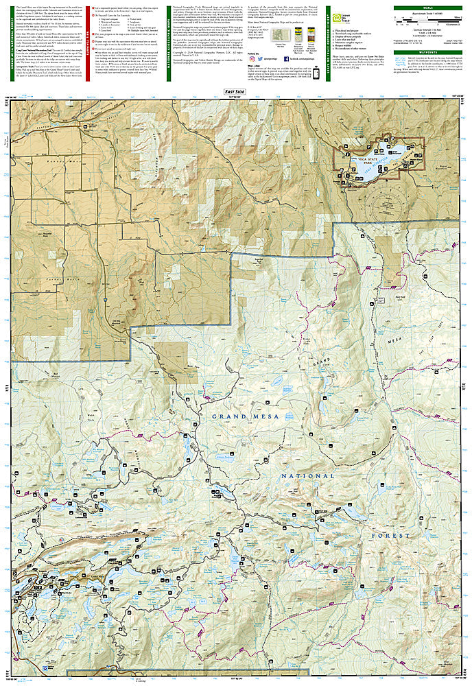
National Geographic Trails Illustrated Grand Mesa Map #136 — waterproof, tear-resistant, scale 1:63,360. Coverage of Grand Mesa National Forest including hundreds of fishing lakes, the Grand Mesa Scenic Byway, and surrounding trails and OHV routes in western Colorado. GPS-compatible.
The National Geographic Trails Illustrated Grand Mesa Map covers Grand Mesa — the world's largest flat-topped mountain — and surrounding Grand Mesa National Forest in western Colorado. The mesa's 300+ fishing lakes, Grand Mesa Scenic Byway, hiking and OHV trails, and surrounding forest lands are mapped in detail with GPS coordinates.
Key specs
- SKU: NGTI136
- Map number: 136
- Scale: 1:63,360
- Coverage: Grand Mesa National Forest, Colorado
- Material: Waterproof, tear-resistant paper
- Features: 300+ fishing lakes, Grand Mesa Scenic Byway, hiking and OHV trails, campgrounds, GPS coordinates
Why it works
Grand Mesa's 300+ lakes make it one of the premier fishing destinations in Colorado, but the mesa's flat top and dense lake network make navigation surprisingly challenging without a detailed map — knowing which lakes hold fish and how to reach them efficiently requires accurate lake and trail mapping. The OHV trail network and the Scenic Byway add significant recreation coverage. Waterproof construction survives the afternoon thunderstorms common on the mesa's exposed top.
Ideal for
Anglers, OHV riders, campers, and outdoor enthusiasts exploring Grand Mesa National Forest in western Colorado. See also NGTI208 (Colorado National Monument) for adjacent canyon country coverage near Grand Junction.
Share