National Geographic
Deckers, Rampart Range: Map #135
Deckers, Rampart Range: Map #135
Couldn't load pickup availability
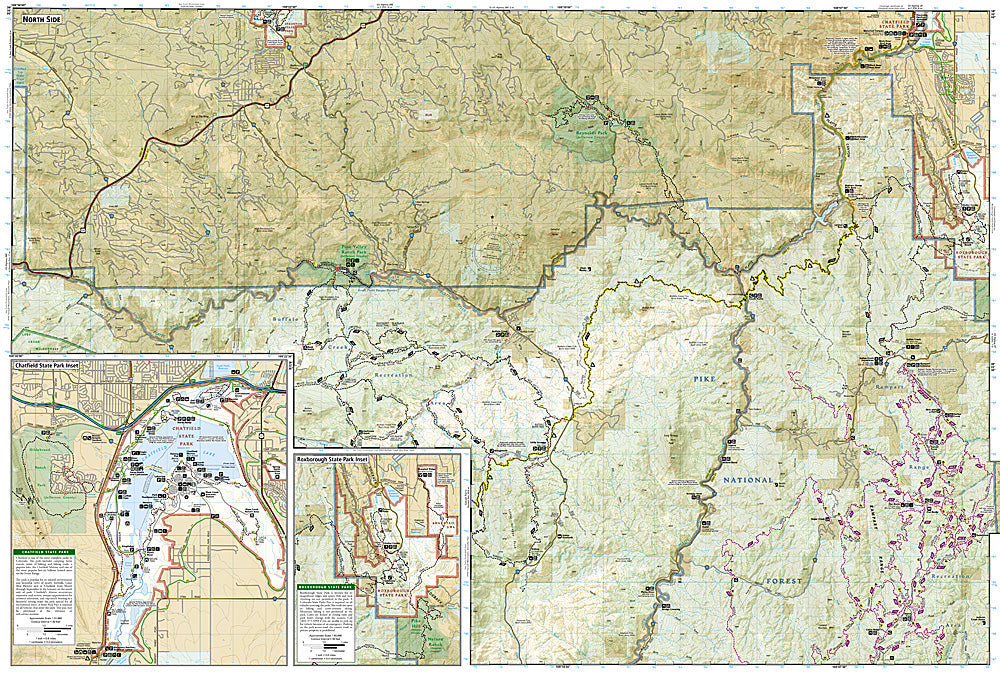
National Geographic Trails Illustrated Deckers & Rampart Range Map #135 — waterproof, tear-resistant, scale 1:40,000. Coverage of the Rampart Range OHV area, Deckers South Platte River fishing, and surrounding Pike National Forest south of Denver, Colorado. GPS-compatible.
The National Geographic Trails Illustrated Deckers & Rampart Range Map covers the Rampart Range and Deckers area in Pike National Forest — the Rampart Range Road OHV corridor, the South Platte River at Deckers (gold-medal trout fishing), and surrounding forest trails and campgrounds. OHV routes, river access, campgrounds, and GPS coordinates are mapped in detail.
Key specs
- SKU: NGTI135
- Map number: 135
- Scale: 1:40,000
- Coverage: Deckers & Rampart Range area, Pike National Forest, Colorado
- Material: Waterproof, tear-resistant paper
- Features: OHV routes, Rampart Range Road, South Platte River access, campgrounds, GPS coordinates
Why it works
The Rampart Range is one of the most popular OHV areas accessible from Denver, with the Rampart Range Road providing a scenic forest drive and access to an extensive OHV trail network — detailed route and campground mapping is essential for visitors navigating the complex forest road system. The Deckers stretch of the South Platte is one of Colorado's premier gold-medal trout fisheries. Waterproof construction survives the Pike National Forest's afternoon thunderstorms.
Ideal for
OHV riders, anglers, campers, and outdoor enthusiasts exploring the Rampart Range and Deckers area of Pike National Forest south of Denver. See also NGTI105 (Tarryall Mountains & Kenosha Pass) for adjacent coverage to the west.
Share