National Geographic
Crested Butte, Pearl Pass: Map #131
Crested Butte, Pearl Pass: Map #131
Couldn't load pickup availability
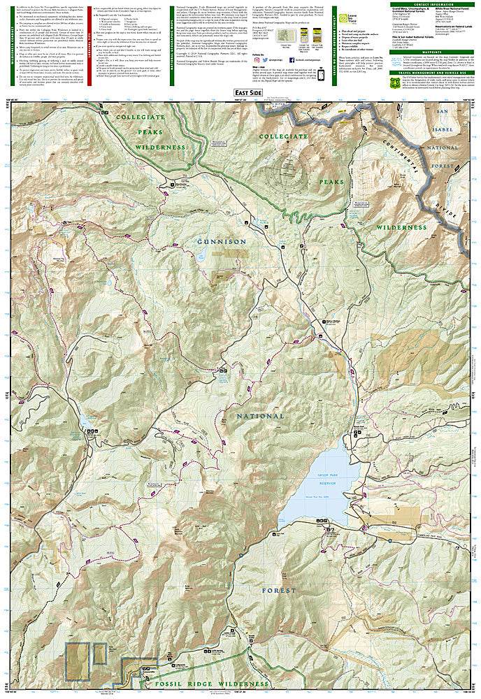
National Geographic Trails Illustrated Crested Butte & Pearl Pass Map #131 — waterproof, tear-resistant, scale 1:40,000. Coverage of the Crested Butte area, Pearl Pass, Maroon Bells-Snowmass Wilderness approach, and surrounding Gunnison National Forest. GPS-compatible.
The National Geographic Trails Illustrated Crested Butte & Pearl Pass Map covers the Crested Butte area and Pearl Pass corridor — the mountain biking trail network surrounding Crested Butte (the self-proclaimed birthplace of mountain biking), Pearl Pass 4WD road connecting to Aspen, the Maroon Bells-Snowmass Wilderness approach, and surrounding Gunnison National Forest. Trails, 4WD routes, wilderness boundaries, trailheads, and GPS coordinates are mapped in detail.
Key specs
- SKU: NGTI131
- Map number: 131
- Scale: 1:40,000
- Coverage: Crested Butte & Pearl Pass area, Gunnison National Forest, Colorado
- Material: Waterproof, tear-resistant paper
- Features: Trails, mountain biking routes, Pearl Pass 4WD road, Maroon Bells-Snowmass Wilderness access, GPS coordinates
Why it works
Crested Butte has one of the most extensive mountain biking trail networks in Colorado, and the Pearl Pass road is one of the most famous 4WD routes in the state — connecting Crested Butte to Aspen over a 12,705-foot pass. The Maroon Bells-Snowmass Wilderness access from the Crested Butte side provides serious backcountry hiking terrain. Waterproof construction survives the Elk Mountains' afternoon thunderstorms and the variable weather common at Crested Butte's high elevation.
Ideal for
Mountain bikers, 4WD enthusiasts, hikers, and backpackers exploring the Crested Butte area, Pearl Pass, and Maroon Bells-Snowmass Wilderness in Colorado. See also NGTI128 (Maroon Bells, Redstone & Marble) for adjacent coverage to the north.
Share