National Geographic
Cowdrey, North Sand Hills: Map #113
Cowdrey, North Sand Hills: Map #113
Couldn't load pickup availability
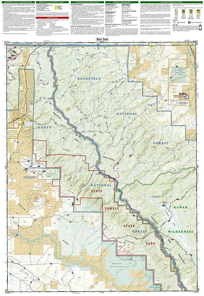
National Geographic Trails Illustrated Cowdrey & North Sand Hills Map #113 — waterproof, tear-resistant, scale 1:63,360. Coverage of the North Sand Hills Recreation Area, North Park, and surrounding public lands in northern Colorado. GPS-compatible.
The National Geographic Trails Illustrated Cowdrey & North Sand Hills Map covers the North Sand Hills Recreation Area and surrounding North Park terrain in northern Colorado — the unique sand dune OHV area, surrounding forests and lakes, and public land boundaries. OHV routes, campgrounds, fishing access, and GPS coordinates are mapped in detail.
Key specs
- SKU: NGTI113
- Map number: 113
- Scale: 1:63,360
- Coverage: Cowdrey & North Sand Hills area, North Park, Colorado
- Material: Waterproof, tear-resistant paper
- Features: OHV routes, North Sand Hills Recreation Area, campgrounds, fishing access, public land boundaries, GPS coordinates
Why it works
The North Sand Hills Recreation Area is one of Colorado's few designated OHV sand dune areas, offering a unique riding experience that requires detailed OHV route and boundary mapping to stay within the designated recreation area. North Park's surrounding lakes and streams add significant fishing coverage. Waterproof construction survives the variable weather common in North Park's high-altitude basin.
Ideal for
OHV riders, campers, hunters, and anglers exploring the North Sand Hills Recreation Area and North Park in northern Colorado. See also NGTI114 (Walden, Gould) for adjacent North Park coverage.
Share