National Geographic
Clark, Buffalo Pass: Map #117
Clark, Buffalo Pass: Map #117
Couldn't load pickup availability
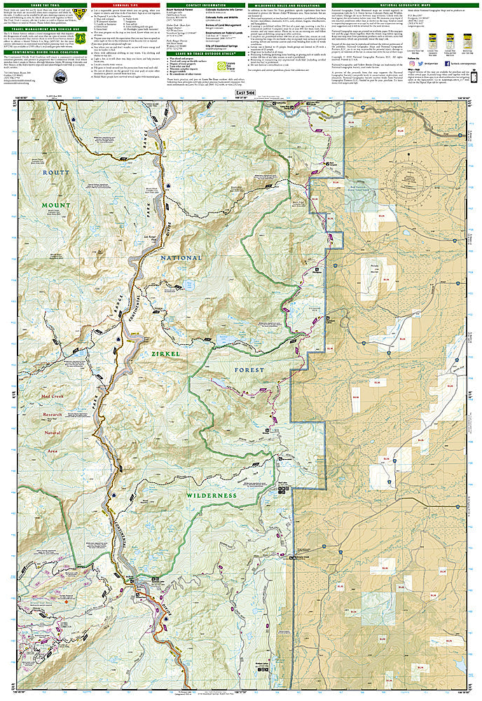
National Geographic Trails Illustrated Clark & Buffalo Pass Map #117 — waterproof, tear-resistant, scale 1:63,360. Coverage of the Mount Zirkel Wilderness, Buffalo Pass, and surrounding Routt National Forest north of Steamboat Springs, Colorado. GPS-compatible.
The National Geographic Trails Illustrated Clark & Buffalo Pass Map covers the Mount Zirkel Wilderness and surrounding Routt National Forest north of Steamboat Springs — the Continental Divide Trail through the Zirkel Wilderness, Buffalo Pass, alpine lakes, and surrounding forest terrain. Trails, CDT route, wilderness boundaries, alpine lakes, campgrounds, and GPS coordinates are mapped in detail.
Key specs
- SKU: NGTI117
- Map number: 117
- Scale: 1:63,360
- Coverage: Clark & Buffalo Pass area, Mount Zirkel Wilderness, Routt National Forest, Colorado
- Material: Waterproof, tear-resistant paper
- Features: Trails, CDT corridor, Mount Zirkel Wilderness, Buffalo Pass, alpine lakes, GPS coordinates
Why it works
The Mount Zirkel Wilderness is one of Colorado's premier backcountry destinations, with the CDT traversing the wilderness's high ridge and the area's dense network of alpine lakes providing excellent fishing and camping. Buffalo Pass provides a key access point to the wilderness from Steamboat Springs. Waterproof construction survives the Routt National Forest's heavy snowpack and the afternoon thunderstorms common in summer.
Ideal for
Backpackers, anglers, CDT hikers, and hunters exploring the Mount Zirkel Wilderness and Buffalo Pass area north of Steamboat Springs. See also NGTI118 (Steamboat Springs, Rabbit Ears) for adjacent coverage to the south.
Share