National Geographic
National Geographic Rocky Mountain National Park Bundle
National Geographic Rocky Mountain National Park Bundle
Couldn't load pickup availability
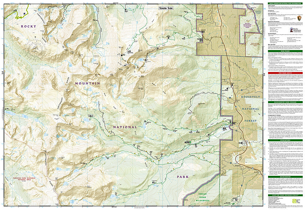
National Geographic Trails Illustrated Rocky Mountain National Park Map Bundle — waterproof, tear-resistant, comprehensive coverage of RMNP including hiking trails, climbing routes, Trail Ridge Road, backcountry campsites, and wildlife areas. For park visitors, hikers, and climbers.
The National Geographic Rocky Mountain National Park Map Bundle includes the Trails Illustrated maps covering the full park — from Longs Peak and the Never Summer Mountains to Trail Ridge Road and the Kawuneeche Valley. Hiking trails, climbing routes, backcountry campsites, shuttle stops, and wildlife areas on waterproof, tear-resistant paper.
Key specs
- SKU: NGTIB061
- Coverage: Rocky Mountain National Park, Colorado (full park)
- Material: Waterproof, tear-resistant paper
- Features: Hiking trails, climbing routes, Trail Ridge Road, backcountry campsites, wildlife areas
- Format: Multi-map bundle
Why it works
Rocky Mountain National Park's trail network spans both the east and west sides of the Continental Divide, with very different terrain and access points on each side — a bundle covering the full park ensures complete coverage without gaps between the eastern Front Range trails and the western Kawuneeche Valley. The backcountry campsite detail is essential for planning permitted overnight trips in the park's heavily regulated backcountry. Waterproof construction survives RMNP's frequent afternoon thunderstorms and the snow that can fall at any time of year above treeline.
Ideal for
Park visitors, hikers, climbers, and wildlife watchers exploring Rocky Mountain National Park. See also NGTMG062 (RMNP Day Hikes Map Pack) for day hike focused coverage.
Share