National Geographic
Rocky Mountain National Park: Map #200
Rocky Mountain National Park: Map #200
Couldn't load pickup availability
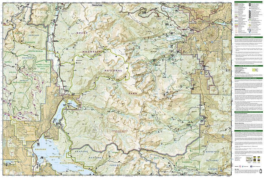
National Geographic Trails Illustrated Rocky Mountain National Park Map #200 — waterproof, tear-resistant, scale 1:40,000. Complete coverage of Rocky Mountain National Park including Trail Ridge Road, Bear Lake corridor, Longs Peak, and the park's full trail network. GPS-compatible.
The National Geographic Trails Illustrated Rocky Mountain National Park Map provides complete coverage of the park — Trail Ridge Road (the highest continuous paved road in the US), the Bear Lake corridor, Longs Peak (14,259 ft), the Mummy Range, Wild Basin, and the full trail network on both the east and west sides of the Continental Divide. Trails, backcountry campsites, trailheads, and GPS coordinates are mapped in detail.
Key specs
- SKU: NGTI200
- Map number: 200
- Scale: 1:40,000
- Coverage: Rocky Mountain National Park, Colorado
- Material: Waterproof, tear-resistant paper
- Features: Full trail network, Trail Ridge Road, Longs Peak route, Bear Lake corridor, backcountry campsites, GPS coordinates
Why it works
Rocky Mountain National Park's timed entry permit system, shuttle-dependent trailheads, and complex trail network on both sides of the Continental Divide require a comprehensive map covering the full park. Longs Peak's Keyhole Route is one of the most popular 14er climbs in Colorado and requires accurate route and approach detail. Waterproof construction survives the park's afternoon thunderstorms and the variable weather common above treeline on Trail Ridge Road.
Ideal for
Hikers, backpackers, mountaineers, and park visitors exploring all areas of Rocky Mountain National Park. See also NGTI1701 (RMNP Day Hikes) for a day-hike focused companion map.
Share