National Geographic
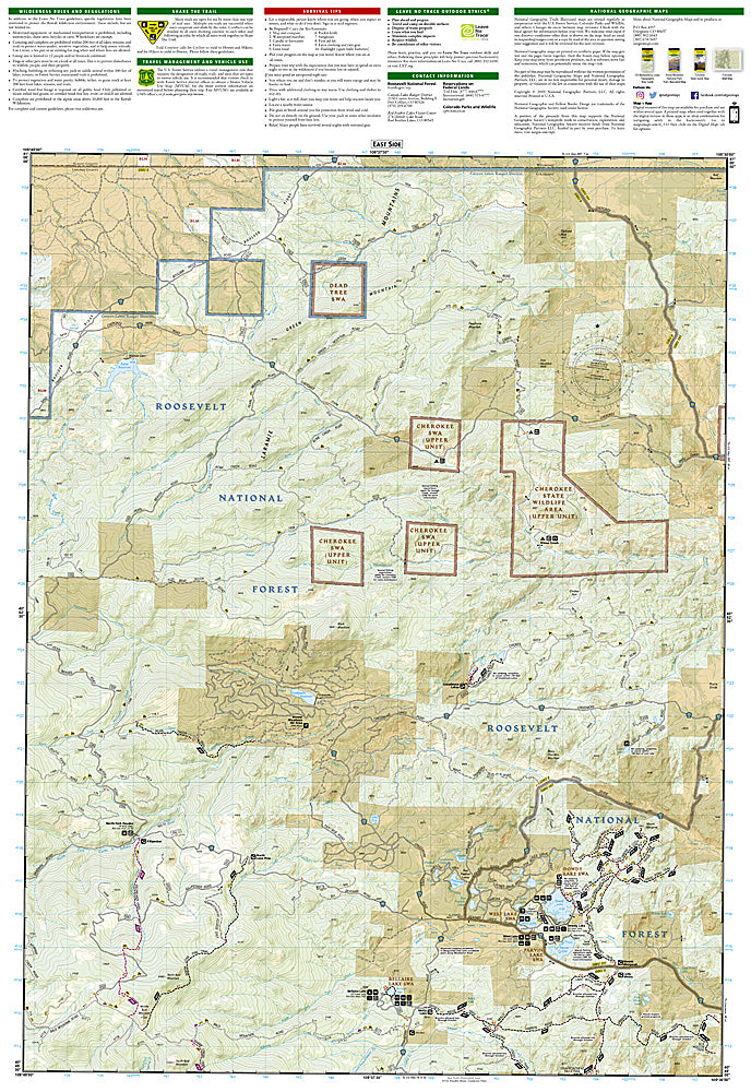
Red Feather Lakes, Glendevey: Map #111
Red Feather Lakes, Glendevey: Map #111
Couldn't load pickup availability
National Geographic Trails Illustrated Red Feather Lakes & Glendevey Map #111 — waterproof, tear-resistant, scale 1:63,360. Coverage of the Red Feather Lakes area, Glendevey, and surrounding Roosevelt National Forest in northern Colorado. GPS-compatible.
The National Geographic Trails Illustrated Red Feather Lakes & Glendevey Map covers the Red Feather Lakes area and Glendevey in northern Colorado's Roosevelt National Forest — the granite domes and lakes of the Laramie River drainage, OHV trails, fishing access, and surrounding forest lands. Trails, OHV routes, campgrounds, fishing access, and GPS coordinates are mapped in detail.
Key specs
- SKU: NGTI111
- Map number: 111
- Scale: 1:63,360
- Coverage: Red Feather Lakes & Glendevey area, Roosevelt National Forest, Colorado
- Material: Waterproof, tear-resistant paper
- Features: Trails, OHV routes, Red Feather Lakes, fishing access, campgrounds, GPS coordinates
Why it works
The Red Feather Lakes area is one of northern Colorado's most popular family camping and fishing destinations, with a network of lakes and granite outcrops that require detailed access point mapping. The OHV trail network and the Laramie River drainage add significant recreation coverage for riders and anglers. Waterproof construction survives the afternoon thunderstorms common in northern Colorado's foothills.
Ideal for
Campers, anglers, OHV riders, and families exploring the Red Feather Lakes area and Glendevey in northern Colorado. See also NGTI101 (Cache La Poudre, Big Thompson) for adjacent coverage to the south.
Share