National Geographic
Poudre River, Cameron Pass: Map #112
Poudre River, Cameron Pass: Map #112
Couldn't load pickup availability
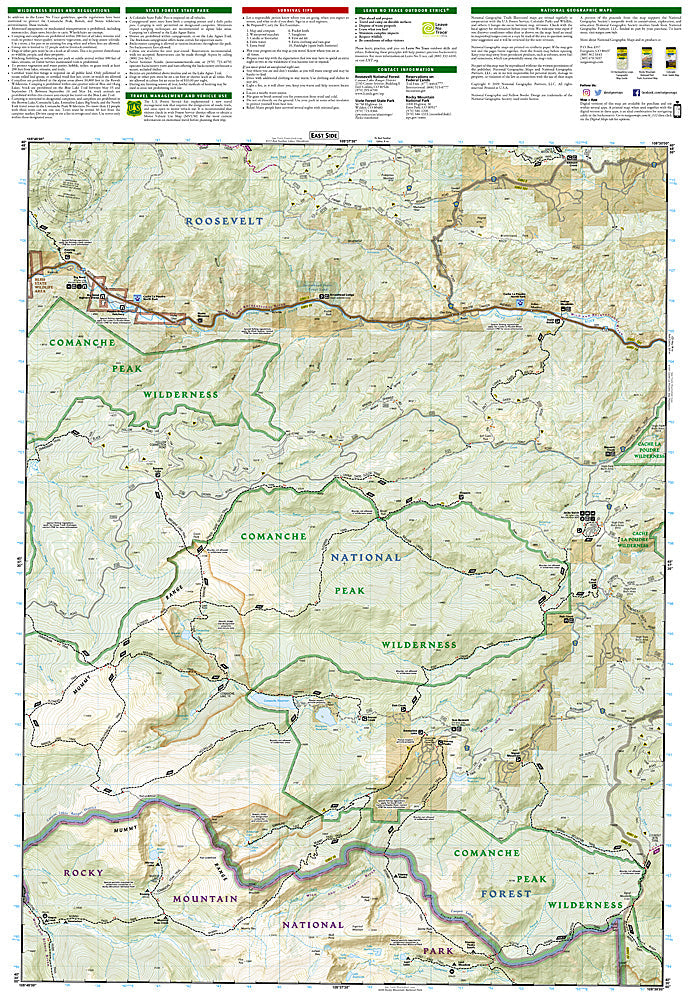
National Geographic Trails Illustrated Poudre River & Cameron Pass Map #112 — waterproof, tear-resistant, scale 1:63,360. Coverage of the Cache la Poudre River upper canyon, Cameron Pass, Rawah Wilderness, and surrounding Roosevelt National Forest in northern Colorado. GPS-compatible.
The National Geographic Trails Illustrated Poudre River & Cameron Pass Map covers the upper Cache la Poudre River canyon and Cameron Pass area in northern Colorado — the Rawah Wilderness, Cameron Pass (10,276 ft), the Michigan River drainage, and surrounding Roosevelt National Forest. Trails, Rawah Wilderness boundaries, fishing access, campgrounds, trailheads, and GPS coordinates are mapped in detail.
Key specs
- SKU: NGTI112
- Map number: 112
- Scale: 1:63,360
- Coverage: Poudre River & Cameron Pass area, Roosevelt National Forest, Colorado
- Material: Waterproof, tear-resistant paper
- Features: Trails, Rawah Wilderness, Cameron Pass, Cache la Poudre fishing access, campgrounds, GPS coordinates
Why it works
The upper Poudre canyon and Cameron Pass area offer some of northern Colorado's best backcountry hiking and fishing in the Rawah Wilderness, with the pass providing access to the Never Summer Mountains and the Michigan River drainage. The Rawah Wilderness's lake-studded terrain requires detailed trail and lake mapping for navigation. Waterproof construction survives the Roosevelt National Forest's afternoon thunderstorms and the variable weather common at Cameron Pass's high elevation.
Ideal for
Anglers, hikers, backpackers, and outdoor enthusiasts exploring the Rawah Wilderness, upper Poudre River, and Cameron Pass area in northern Colorado. See also NGTI101 (Cache La Poudre & Big Thompson) for the lower canyon coverage.
Share