National Geographic
Maroon Bells, Redstone, Marble: Map #128
Maroon Bells, Redstone, Marble: Map #128
Couldn't load pickup availability
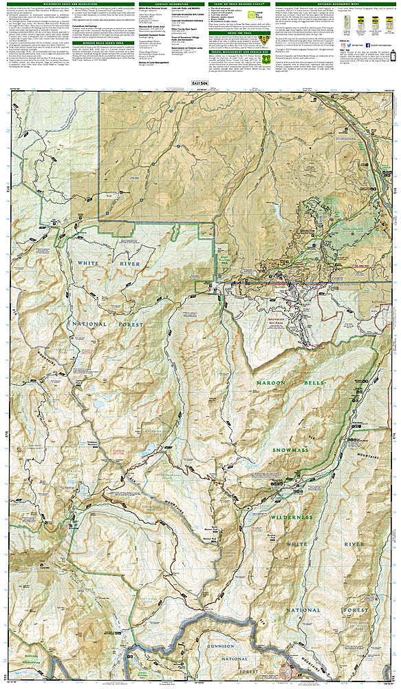
National Geographic Trails Illustrated Maroon Bells, Redstone & Marble Map #128 — waterproof, tear-resistant, scale 1:40,000. Coverage of the Maroon Bells-Snowmass Wilderness, Four Pass Loop, Crystal River Valley, and surrounding White River National Forest. GPS-compatible.
The National Geographic Trails Illustrated Maroon Bells, Redstone & Marble Map covers the Maroon Bells-Snowmass Wilderness and Crystal River Valley — the Maroon Bells (Colorado's most photographed peaks), the Four Pass Loop, Capitol Peak, Snowmass Mountain, and the historic towns of Redstone and Marble. Trails, Four Pass Loop route, wilderness boundaries, climbing routes, and GPS coordinates are mapped in detail.
Key specs
- SKU: NGTI128
- Map number: 128
- Scale: 1:40,000
- Coverage: Maroon Bells-Snowmass Wilderness & Crystal River Valley, Colorado
- Material: Waterproof, tear-resistant paper
- Features: Trails, Four Pass Loop, Maroon Bells, Capitol Peak, Snowmass Mountain, wilderness boundaries, GPS coordinates
Why it works
The Maroon Bells are the most photographed peaks in North America, and the Four Pass Loop is one of Colorado's premier backpacking routes — detailed trail and campsite mapping is essential for the thousands of backpackers who complete the loop each summer. Capitol Peak's knife-edge ridge is one of Colorado's most technically challenging 14ers, requiring accurate route detail. Waterproof construction survives the Elk Mountains' afternoon thunderstorms and the variable weather common at the Maroon Bells' high elevation.
Ideal for
Backpackers, photographers, mountaineers, and hikers exploring the Maroon Bells-Snowmass Wilderness and Crystal River Valley. See also NGTI127 (Aspen & Independence Pass) for adjacent coverage to the north.
Share