National Geographic
La Garita, Cochetopa Hills: Map #139
La Garita, Cochetopa Hills: Map #139
Couldn't load pickup availability
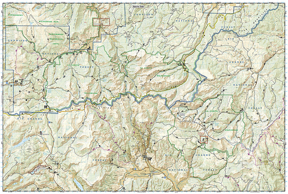
National Geographic Trails Illustrated La Garita & Cochetopa Hills Map #139 — waterproof, tear-resistant, scale 1:63,360. Coverage of the La Garita Wilderness, Cochetopa Hills, Wheeler Geologic Area, and surrounding Gunnison and Rio Grande National Forests. GPS-compatible.
The National Geographic Trails Illustrated La Garita & Cochetopa Hills Map covers the La Garita Wilderness and Cochetopa Hills in southern Colorado — the Wheeler Geologic Area (a remote volcanic formation accessible only by trail), the Continental Divide Trail and Colorado Trail corridors, and surrounding national forest lands. Trails, CDT/CT routes, wilderness boundaries, trailheads, and GPS coordinates are mapped in detail.
Key specs
- SKU: NGTI139
- Map number: 139
- Scale: 1:63,360
- Coverage: La Garita Wilderness & Cochetopa Hills, Colorado
- Material: Waterproof, tear-resistant paper
- Features: Trails, CDT/Colorado Trail, La Garita Wilderness, Wheeler Geologic Area, wilderness boundaries, GPS coordinates
Why it works
The La Garita Wilderness is one of Colorado's most remote and least-visited wilderness areas, with the Wheeler Geologic Area requiring a 14-mile round-trip hike to reach — accurate trail and terrain mapping is essential for navigation in this seldom-visited terrain. The CDT and Colorado Trail corridors add significant long-distance route coverage. Waterproof construction survives the San Juan Mountains' afternoon thunderstorms and the variable weather common in southern Colorado's high country.
Ideal for
Solitude seekers, CDT hikers, Colorado Trail users, and geology enthusiasts exploring the La Garita Wilderness and Wheeler Geologic Area in southern Colorado. See also NGTI140 (Weminuche Wilderness) for adjacent coverage to the south.
Share