National Geographic
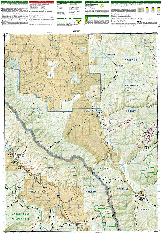
Green Mountain Reservoir, Ute Pass: Map #107
Green Mountain Reservoir, Ute Pass: Map #107
Couldn't load pickup availability
National Geographic Trails Illustrated Green Mountain Reservoir & Ute Pass Map #107 — waterproof, tear-resistant, scale 1:63,360. Coverage of Green Mountain Reservoir, Ute Pass, Williams Fork Mountains, and surrounding Eagles Nest Wilderness access in Colorado. GPS-compatible.
The National Geographic Trails Illustrated Green Mountain Reservoir & Ute Pass Map covers the Green Mountain Reservoir area and Ute Pass corridor in north-central Colorado — Green Mountain Reservoir, the Williams Fork Mountains, Ute Pass, and the southern Eagles Nest Wilderness access. Trails, boating access, hunting areas, campgrounds, trailheads, and GPS coordinates are mapped in detail.
Key specs
- SKU: NGTI107
- Map number: 107
- Scale: 1:63,360
- Coverage: Green Mountain Reservoir & Ute Pass area, Colorado
- Material: Waterproof, tear-resistant paper
- Features: Trails, Green Mountain Reservoir, Williams Fork Mountains, Eagles Nest Wilderness access, campgrounds, GPS coordinates
Why it works
Green Mountain Reservoir is a popular boating and fishing destination between Kremmling and Silverthorne, and the surrounding Williams Fork Mountains offer hunting and hiking terrain that requires detailed mapping to navigate. The southern Eagles Nest Wilderness access adds significant backcountry coverage. Waterproof construction survives the variable weather common in Colorado's high-altitude reservoir country.
Ideal for
Boaters, anglers, hunters, and hikers exploring Green Mountain Reservoir and the Williams Fork Mountains in Colorado. See also NGTI108 (Vail, Frisco, Dillon) for adjacent coverage to the south.
Share