National Geographic
Dinosaur National Monument: Map #220
Dinosaur National Monument: Map #220
Couldn't load pickup availability
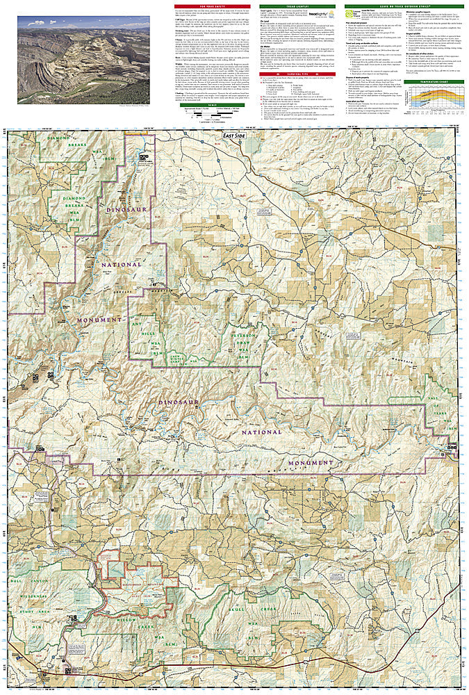
National Geographic Trails Illustrated Dinosaur National Monument Map #220 — waterproof, tear-resistant. Coverage of Dinosaur National Monument including the Dinosaur Quarry, Green River, Yampa River, and surrounding canyon terrain in Utah and Colorado. GPS-compatible.
The National Geographic Trails Illustrated Dinosaur National Monument Map covers the full monument spanning Utah and Colorado — the Dinosaur Quarry (one of the world's richest dinosaur fossil sites), the Green River and Yampa River canyons, Echo Park, Harpers Corner, and surrounding desert terrain. River routes, hiking trails, campgrounds, and GPS coordinates are mapped in detail.
Key specs
- SKU: NGTI220
- Map number: 220
- Coverage: Dinosaur National Monument (UT/CO)
- Material: Waterproof, tear-resistant paper
- Features: Dinosaur Quarry, Green & Yampa River routes, Echo Park, hiking trails, campgrounds, GPS coordinates
Why it works
Dinosaur National Monument's combination of world-class paleontology and premier whitewater rafting on the Green and Yampa Rivers requires a map covering both the fossil sites and the river corridors. The monument's remote canyon terrain and the multi-day river trips require detailed campsite and rapid location mapping for safe planning. Waterproof construction survives the river environment and the desert heat common in the Utah-Colorado canyon country.
Ideal for
Rafters, dinosaur enthusiasts, hikers, and desert explorers visiting Dinosaur National Monument's fossil quarry and river canyons in Utah and Colorado. See also NGTI220 for adjacent coverage.
Share