National Geographic
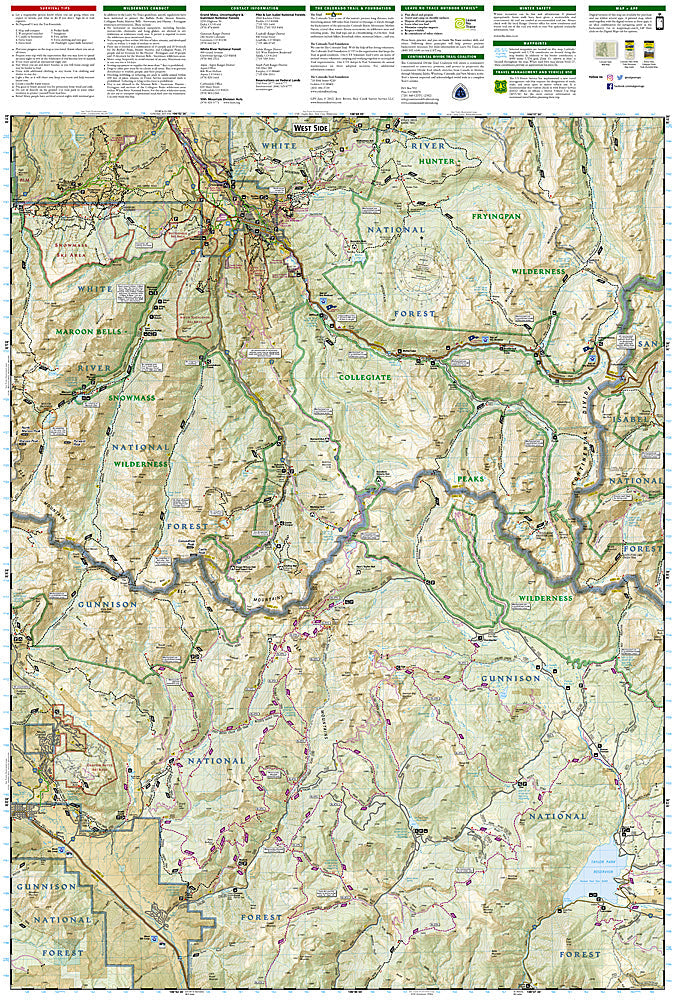
Collegiate Peaks Wilderness: Map #148
Collegiate Peaks Wilderness: Map #148
Couldn't load pickup availability
National Geographic Trails Illustrated Collegiate Peaks Wilderness Map #148 — waterproof, tear-resistant, scale 1:63,360. Coverage of the Collegiate Peaks Wilderness including Mount Harvard, Mount Columbia, Mount Yale, Mount Oxford, and surrounding Sawatch Range terrain in Colorado. GPS-compatible.
The National Geographic Trails Illustrated Collegiate Peaks Wilderness Map covers the Collegiate Peaks Wilderness in the central Sawatch Range — Mount Harvard (14,420 ft), Mount Columbia, Mount Yale, Mount Oxford, and the surrounding wilderness terrain. Trails, 14er routes, wilderness boundaries, trailheads, and GPS coordinates are mapped in detail.
Key specs
- SKU: NGTI148
- Map number: 148
- Scale: 1:63,360
- Coverage: Collegiate Peaks Wilderness, Colorado (central Sawatch Range)
- Material: Waterproof, tear-resistant paper
- Features: Trails, Collegiate Peaks 14er routes, wilderness boundaries, trailheads, GPS coordinates
Why it works
The Collegiate Peaks Wilderness contains four 14ers — Harvard, Columbia, Yale, and Oxford — that are among the most popular in Colorado due to their relatively straightforward approach routes from Buena Vista. Accurate trail and route mapping is essential for navigating the approach drainages and ridge connections between summits. Waterproof construction survives the Sawatch Range's afternoon thunderstorms that are a constant hazard on the exposed 14er ridgelines.
Ideal for
Peak baggers, backpackers, and wilderness hikers exploring the Collegiate Peaks Wilderness and its four 14ers in the central Sawatch Range. See also NGTI129 (Buena Vista, Collegiate Peaks) for broader area coverage and NGTIB222 (Collegiate Peaks & Eagles Nest GMU Bundle) for hunting coverage.
Share