National Geographic
Cache La Poudre, Big Thompson: Map #101
Cache La Poudre, Big Thompson: Map #101
Couldn't load pickup availability
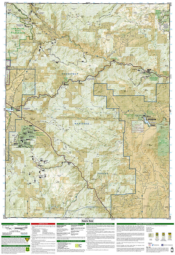
National Geographic Trails Illustrated Cache La Poudre & Big Thompson Map #101 — waterproof, tear-resistant, scale 1:40,000. Coverage of the Cache La Poudre Wild & Scenic River, Big Thompson Canyon, and surrounding Roosevelt National Forest west of Fort Collins and Loveland, Colorado. GPS-compatible.
The National Geographic Trails Illustrated Cache La Poudre & Big Thompson Map covers the river canyons west of Fort Collins and Loveland — the Cache La Poudre Wild & Scenic River corridor, Big Thompson Canyon, Comanche Peak Wilderness, and surrounding Roosevelt National Forest. Trails, climbing areas, fishing access, campgrounds, trailheads, and GPS coordinates are mapped in detail.
Key specs
- SKU: NGTI101
- Map number: 101
- Scale: 1:40,000
- Coverage: Cache La Poudre & Big Thompson area, Roosevelt National Forest, Colorado
- Material: Waterproof, tear-resistant paper
- Features: Trails, Cache La Poudre river corridor, Big Thompson Canyon, Comanche Peak Wilderness, climbing areas, GPS coordinates
Why it works
The Cache La Poudre is Colorado's only designated Wild & Scenic River, offering world-class whitewater kayaking and gold-medal trout fishing in a canyon accessible from Fort Collins — detailed river access and fishing hole mapping is essential for anglers and paddlers. The Comanche Peak Wilderness and the canyon's climbing areas add significant hiking and climbing coverage. Waterproof construction survives the canyon's variable weather and the river environment.
Ideal for
Anglers, kayakers, hikers, and climbers exploring the Cache La Poudre and Big Thompson canyons west of Fort Collins. See also NGTI200 (Rocky Mountain National Park) for adjacent coverage to the west.
Share