National Geographic
Buena Vista, Collegiate Peaks: Map #129
Buena Vista, Collegiate Peaks: Map #129
Couldn't load pickup availability
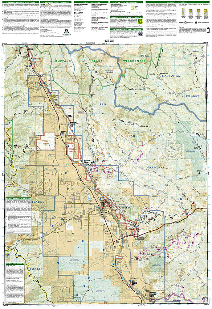
National Geographic Trails Illustrated Buena Vista & Collegiate Peaks Map #129 — waterproof, tear-resistant, scale 1:40,000. Coverage of the Buena Vista area, Collegiate Peaks Wilderness, Arkansas River, and surrounding Sawatch Range terrain in Colorado. GPS-compatible.
The National Geographic Trails Illustrated Buena Vista & Collegiate Peaks Map covers the Arkansas River valley and surrounding Sawatch Range — the Collegiate Peaks Wilderness (Harvard, Columbia, Yale, Oxford), Buena Vista's Arkansas River whitewater, and surrounding San Isabel National Forest. Trails, 14er approach routes, rafting put-ins, wilderness boundaries, and GPS coordinates are mapped in detail.
Key specs
- SKU: NGTI129
- Map number: 129
- Scale: 1:40,000
- Coverage: Buena Vista & Collegiate Peaks area, Colorado (Sawatch Range)
- Material: Waterproof, tear-resistant paper
- Features: Trails, Collegiate Peaks 14er approaches, Arkansas River rafting access, wilderness boundaries, GPS coordinates
Why it works
Buena Vista is the gateway to both the Collegiate Peaks 14ers and the Arkansas River's world-class whitewater — a single map covering both the mountain approaches and the river access points is far more practical than managing separate maps for each activity. The Collegiate Peaks' four 14ers are among Colorado's most popular, and their approach routes from the Buena Vista side require detailed trail mapping. Waterproof construction survives the Sawatch Range's afternoon thunderstorms and the river environment.
Ideal for
Peak baggers, rafters, backpackers, and outdoor enthusiasts exploring the Buena Vista area and Collegiate Peaks Wilderness in Colorado. See also NGTI148 (Collegiate Peaks Wilderness) for dedicated wilderness coverage.
Share