National Geographic
Black Mesa, Curecanti Pass: Map #134
Black Mesa, Curecanti Pass: Map #134
Couldn't load pickup availability
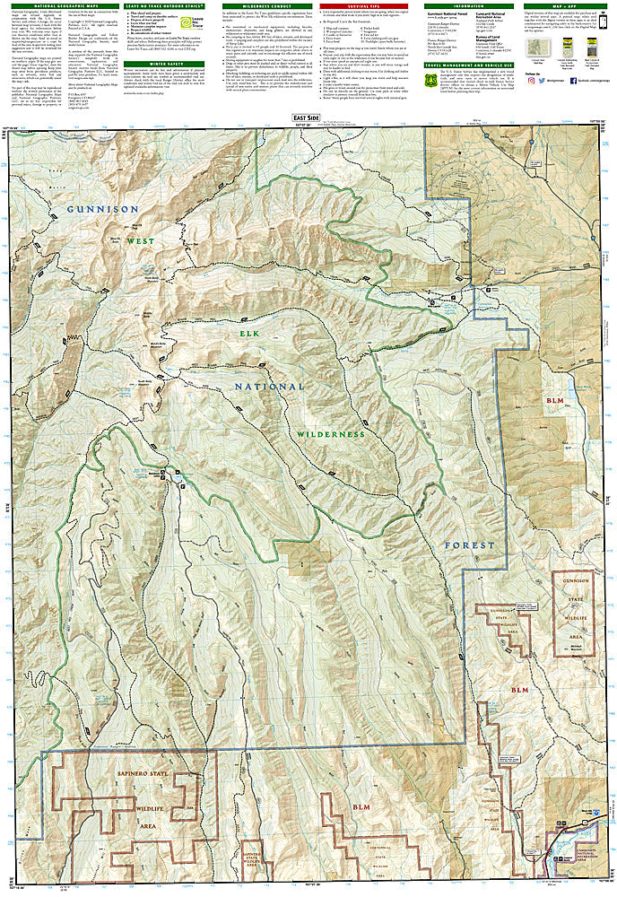
National Geographic Trails Illustrated Black Mesa & Curecanti Pass Map #134 — waterproof, tear-resistant, scale 1:63,360. Coverage of Black Mesa, Curecanti National Recreation Area, Blue Mesa Reservoir, and surrounding Gunnison National Forest in Colorado. GPS-compatible.
The National Geographic Trails Illustrated Black Mesa & Curecanti Pass Map covers the Black Mesa area and Curecanti National Recreation Area in western Colorado — Blue Mesa Reservoir (Colorado's largest body of water), Morrow Point Reservoir, Crystal Reservoir, the Black Canyon of the Gunnison approach, and surrounding Gunnison National Forest. Trails, boating access, campgrounds, trailheads, and GPS coordinates are mapped in detail.
Key specs
- SKU: NGTI134
- Map number: 134
- Scale: 1:63,360
- Coverage: Black Mesa & Curecanti NRA, Colorado (Blue Mesa Reservoir area)
- Material: Waterproof, tear-resistant paper
- Features: Trails, Blue Mesa Reservoir, boating access, campgrounds, Black Canyon approach, GPS coordinates
Why it works
Blue Mesa Reservoir is Colorado's largest body of water and a premier fishing and boating destination — detailed boat ramp, marina, and campground mapping is essential for visitors planning water-based recreation. The mesa top trails and the approach to the Black Canyon of the Gunnison add significant hiking coverage. Waterproof construction survives the variable weather common in western Colorado's high desert terrain.
Ideal for
Anglers, boaters, hikers, and campers exploring Curecanti National Recreation Area and Blue Mesa Reservoir in western Colorado. See also NGTI245 (Black Canyon of the Gunnison NP) for adjacent canyon coverage.
Share