National Geographic
Steamboat Springs, Rabbit Ears: Map #118
Steamboat Springs, Rabbit Ears: Map #118
Couldn't load pickup availability
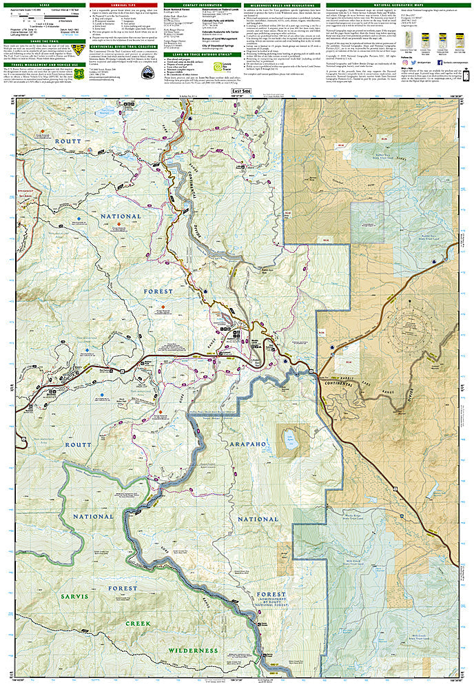
National Geographic Trails Illustrated Steamboat Springs & Rabbit Ears Map #118 — waterproof, tear-resistant, scale 1:63,360. Coverage of the Steamboat Springs area, Rabbit Ears Pass, Mount Zirkel Wilderness approach, and surrounding Routt National Forest in Colorado. GPS-compatible.
The National Geographic Trails Illustrated Steamboat Springs & Rabbit Ears Map covers the Steamboat Springs area and Rabbit Ears Pass corridor — the Steamboat ski area, Rabbit Ears Pass, the Continental Divide Trail, and surrounding Routt National Forest. Hiking and mountain biking trails, ski terrain, CDT route, campgrounds, and GPS coordinates are mapped in detail.
Key specs
- SKU: NGTI118
- Map number: 118
- Scale: 1:63,360
- Coverage: Steamboat Springs & Rabbit Ears Pass area, Routt National Forest, Colorado
- Material: Waterproof, tear-resistant paper
- Features: Trails, Rabbit Ears Pass, CDT corridor, ski terrain, mountain biking routes, campgrounds, GPS coordinates
Why it works
Steamboat Springs is one of Colorado's premier four-season outdoor recreation destinations, with Rabbit Ears Pass providing summer hiking and winter snowshoeing terrain directly accessible from town. The CDT's passage through the area and the surrounding Routt National Forest's extensive trail network require detailed mapping for navigation. Waterproof construction survives the Steamboat area's heavy snowpack and the afternoon thunderstorms common in summer.
Ideal for
Skiers, mountain bikers, hikers, and outdoor enthusiasts exploring the Steamboat Springs area, Rabbit Ears Pass, and surrounding Routt National Forest. See also NGTI117 (Clark, Buffalo Pass) for adjacent coverage to the north.
Share