National Geographic
Kremmling, Granby: Map #106
Kremmling, Granby: Map #106
Couldn't load pickup availability
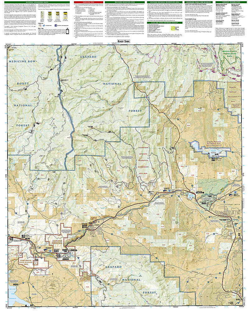
National Geographic Trails Illustrated Kremmling & Granby Map #106 — waterproof, tear-resistant, scale 1:63,360. Coverage of the Kremmling and Granby area including the Colorado River headwaters, Wolford Mountain Reservoir, and surrounding Middle Park terrain. GPS-compatible.
The National Geographic Trails Illustrated Kremmling & Granby Map covers Middle Park in north-central Colorado — the Colorado River headwaters near Kremmling, Wolford Mountain Reservoir, Lake Granby, and surrounding Arapaho National Forest. Trails, river access, OHV routes, fishing access, campgrounds, and GPS coordinates are mapped in detail.
Key specs
- SKU: NGTI106
- Map number: 106
- Scale: 1:63,360
- Coverage: Kremmling & Granby area, Middle Park, Colorado
- Material: Waterproof, tear-resistant paper
- Features: Trails, Colorado River access, Wolford Mountain Reservoir, Lake Granby, OHV routes, GPS coordinates
Why it works
The Kremmling area is the gateway to the Colorado River's upper canyon and one of Colorado's premier gold-medal trout fishing destinations — detailed river access and fishing hole mapping is essential for anglers. Lake Granby and Wolford Mountain Reservoir add boating and camping coverage. Waterproof construction survives the variable weather common in Middle Park's high-altitude basin.
Ideal for
Anglers, boaters, OHV riders, and outdoor enthusiasts exploring the Kremmling and Granby area of Middle Park, Colorado. See also NGTI107 (Green Mountain Reservoir, Ute Pass) for adjacent coverage to the east.
Share