National Geographic
Flat Tops Wilderness South: Map #151
Flat Tops Wilderness South: Map #151
Couldn't load pickup availability
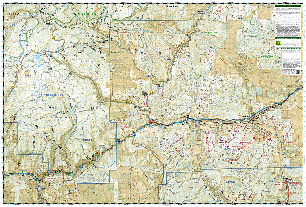
National Geographic Trails Illustrated Flat Tops Wilderness South Map #151 — waterproof, tear-resistant, scale 1:63,360. Coverage of the southern Flat Tops Wilderness, Trappers Lake, and surrounding White River National Forest in northwestern Colorado. GPS-compatible.
The National Geographic Trails Illustrated Flat Tops Wilderness South Map covers the southern section of the Flat Tops Wilderness — the massive volcanic plateau, Trappers Lake (the birthplace of the US wilderness concept), and surrounding White River National Forest. Trails, fishing lakes, wilderness boundaries, equestrian routes, trailheads, and GPS coordinates are mapped in detail.
Key specs
- SKU: NGTI151
- Map number: 151
- Scale: 1:63,360
- Coverage: Flat Tops Wilderness South, White River National Forest, Colorado
- Material: Waterproof, tear-resistant paper
- Features: Trails, Trappers Lake, fishing lakes, wilderness boundaries, equestrian routes, GPS coordinates
Why it works
The Flat Tops Wilderness is Colorado's second-largest wilderness area and one of the most unique landscapes in the state — a massive volcanic plateau with hundreds of lakes and the dramatic cliffs of the Flat Tops rim. Trappers Lake's historical significance as the birthplace of the US wilderness concept makes it a destination in its own right. Waterproof construction survives the Flat Tops' frequent afternoon thunderstorms and the variable weather common on the exposed plateau.
Ideal for
Anglers, equestrians, backpackers, and outdoor enthusiasts exploring the southern Flat Tops Wilderness and Trappers Lake in northwestern Colorado. See also NGTI150 (Flat Tops Wilderness North) for the northern section.
Share