National Geographic
Yosemite SW, Valley & Wawona: Map #306
Yosemite SW, Valley & Wawona: Map #306
Couldn't load pickup availability
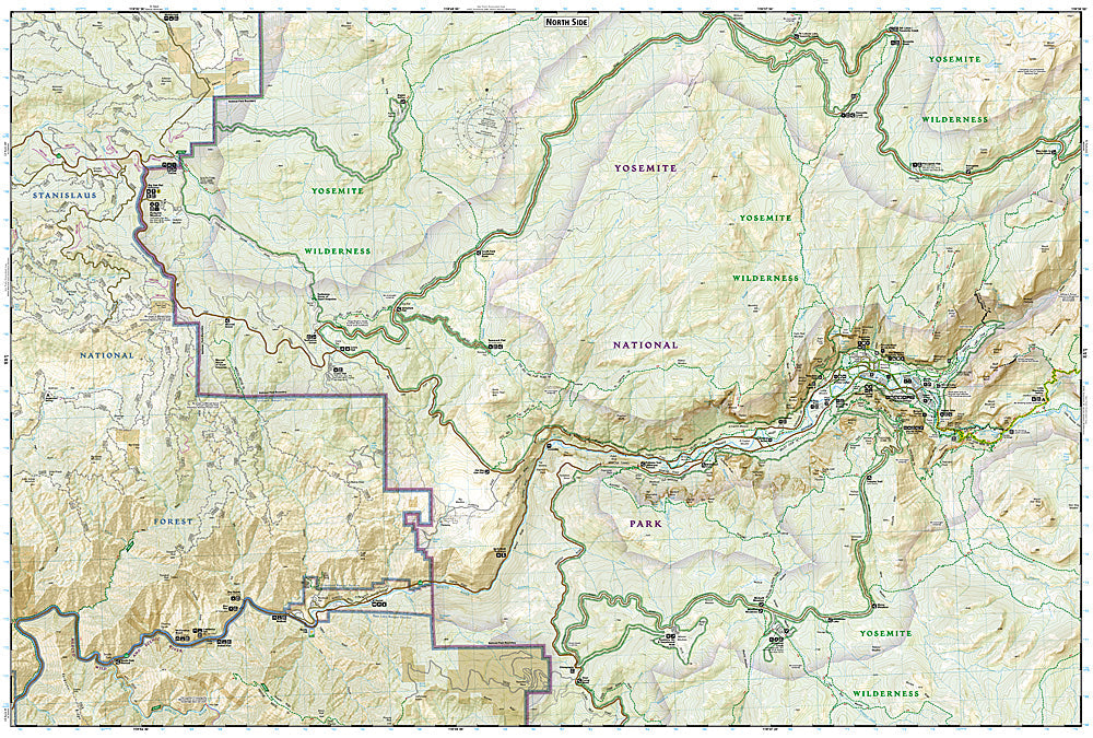
National Geographic Trails Illustrated Yosemite SW, Valley & Wawona Map #306 — waterproof, tear-resistant. Coverage of Yosemite Valley, Wawona, the Mariposa Grove of Giant Sequoias, and surrounding southwestern Yosemite National Park terrain. GPS-compatible.
The National Geographic Trails Illustrated Yosemite SW, Valley & Wawona Map covers the heart of Yosemite National Park — Yosemite Valley (El Capitan, Half Dome, Yosemite Falls, Bridalveil Fall), Wawona, the Mariposa Grove of Giant Sequoias, and the Glacier Point Road corridor. Trails, valley shuttle stops, climbing areas, backcountry campsites, and GPS coordinates are mapped in detail.
Key specs
- SKU: NGTI306
- Map number: 306
- Coverage: Yosemite Valley, Wawona & Mariposa Grove, Yosemite National Park, California
- Material: Waterproof, tear-resistant paper
- Features: Trails, El Capitan, Half Dome, Yosemite Falls, Mariposa Grove, shuttle stops, climbing areas, GPS coordinates
Why it works
Yosemite Valley is the most visited destination in the Sierra Nevada, with the valley's complex trail network, shuttle system, and permit-required destinations (Half Dome cables) requiring accurate mapping for visitor planning. The Mariposa Grove's giant sequoia trail network and the Glacier Point Road's overlooks add significant coverage beyond the valley floor. Waterproof construction survives the Sierra Nevada's afternoon thunderstorms and the variable weather common in Yosemite year-round.
Ideal for
Park visitors, hikers, rock climbers, and backpackers exploring Yosemite Valley, Wawona, and the Mariposa Grove in Yosemite National Park. See also NGTI308 (Yosemite NE, Tuolumne Meadows) for the high country coverage.
Share