National Geographic
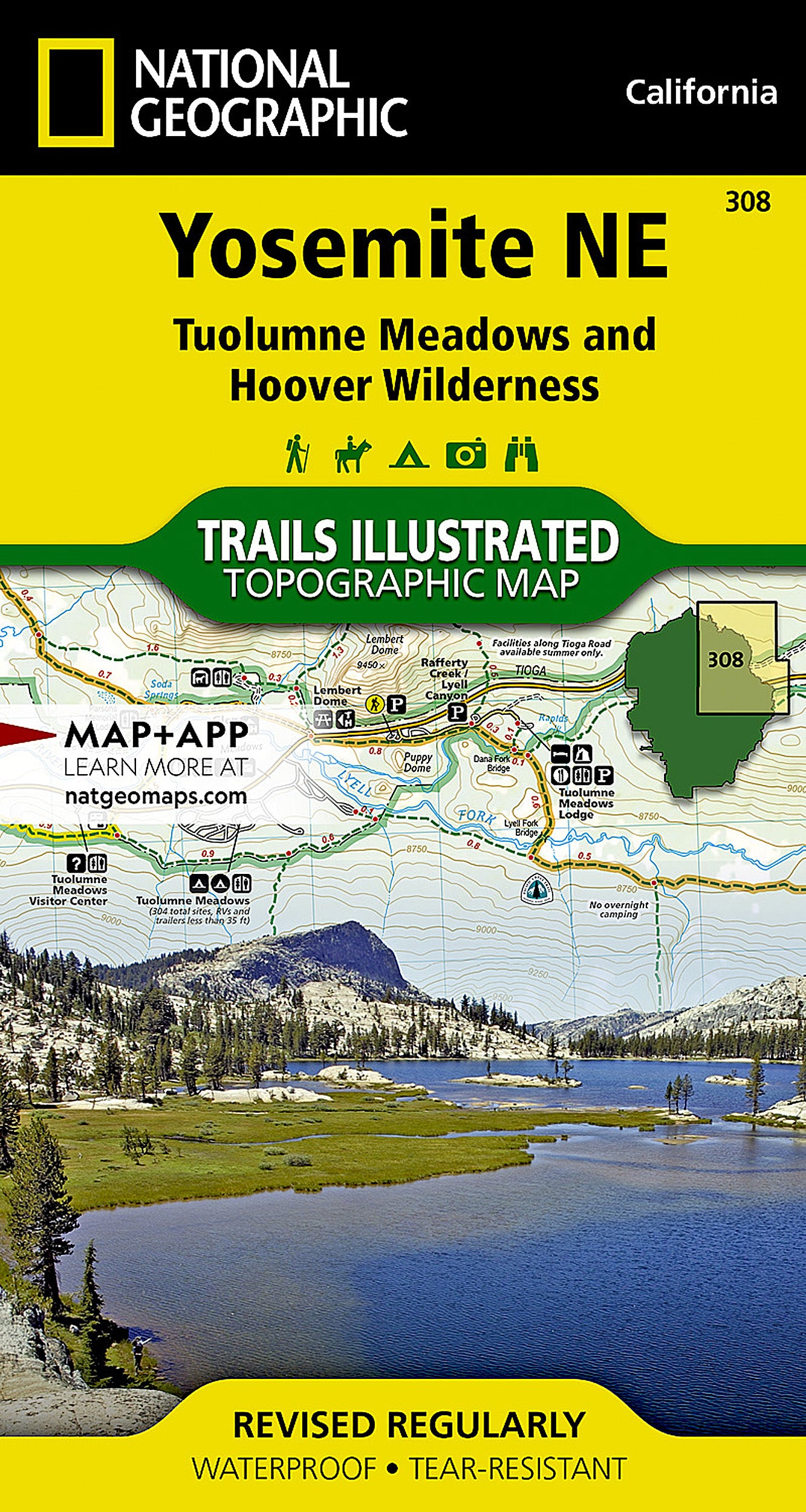
Yosemite NE, Tuolumne & Hoover Wilderness: Map #308
Yosemite NE, Tuolumne & Hoover Wilderness: Map #308
Couldn't load pickup availability
National Geographic Trails Illustrated topo map of Yosemite NE, Tuolumne Meadows, and Hoover Wilderness — waterproof, tear-resistant, GPS-compatible.
National Geographic Trails Illustrated Map 308 covers the northeast corner of Yosemite National Park including Tuolumne Meadows and the adjacent Hoover Wilderness in California. Detailed topographic contours, trails, campsites, wilderness boundaries, and points of interest printed on waterproof, tear-resistant paper. GPS-compatible with UTM grid lines.
Key specs:
- Map number: 308
- Publisher: National Geographic Trails Illustrated
- Region: Yosemite NP NE / Tuolumne Meadows / Hoover Wilderness, California
- Material: Waterproof, tear-resistant paper
- GPS-compatible with UTM grid lines
- Coverage: Tuolumne Meadows, Hoover Wilderness, northeast Yosemite trails, campsites, and wilderness boundaries
- Condition: Brand new
Why it works:
Trails Illustrated maps are the standard reference for Yosemite backcountry navigation — more detailed and recreation-focused than standard USGS quads, printed on waterproof paper that survives Sierra Nevada conditions. Essential for backpackers, climbers, and hikers exploring Tuolumne Meadows and the Hoover Wilderness.
Ideal for: Hikers, backpackers, and climbers exploring Tuolumne Meadows, the Hoover Wilderness, and the northeast corner of Yosemite National Park who need a durable, detailed trail map.
Share