National Geographic
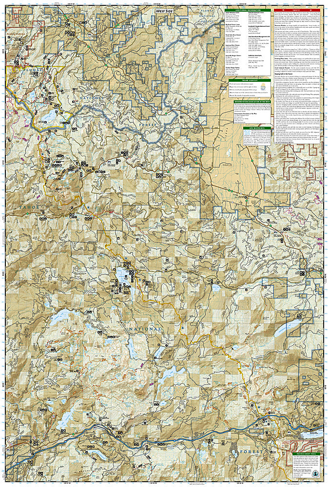
Tahoe National Forest East: Map #805
Tahoe National Forest East: Map #805
Couldn't load pickup availability
National Geographic Trails Illustrated Tahoe National Forest East Map #805 — waterproof, tear-resistant. Coverage of the eastern Tahoe National Forest including the Truckee area, Donner Pass, Castle Peak, and surrounding Sierra Nevada terrain. GPS-compatible.
The National Geographic Trails Illustrated Tahoe National Forest East Map covers the eastern section of the Tahoe National Forest — the Truckee area, Donner Pass, Castle Peak, the Pacific Crest Trail corridor, and surrounding Sierra Nevada terrain. Trails, PCT route, campgrounds, trailheads, and GPS coordinates are mapped in detail.
Key specs
- SKU: NGTI805
- Map number: 805
- Coverage: Tahoe National Forest East (Truckee & Donner Pass area), California
- Material: Waterproof, tear-resistant paper
- Features: Trails, PCT corridor, Donner Pass, Castle Peak, campgrounds, trailheads, GPS coordinates
Why it works
The Truckee and Donner Pass area is one of the most accessible Sierra Nevada recreation zones from the Bay Area and Sacramento, with a dense trail network that requires detailed mapping to navigate efficiently. The Pacific Crest Trail passes through Donner Pass, making accurate PCT and connecting trail detail essential for section hikers. Waterproof construction survives the Sierra Nevada's afternoon thunderstorms and the heavy snowpack that can linger into early summer.
Ideal for
Hikers, PCT section hikers, skiers, and outdoor enthusiasts exploring the eastern Tahoe National Forest around Truckee and Donner Pass. See also NGTI804 (Tahoe National Forest West) and NGTIB241 (Tahoe National Forest Bundle) for complete forest coverage.
Share