National Geographic
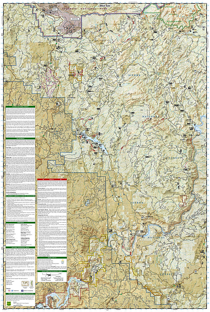
Shaver Lake, Sierra National Forest: Map #810
Shaver Lake, Sierra National Forest: Map #810
Couldn't load pickup availability
National Geographic Trails Illustrated Shaver Lake & Sierra National Forest Map #810 — waterproof, tear-resistant. Coverage of Shaver Lake, Huntington Lake, Kaiser Wilderness, and surrounding Sierra National Forest in the central Sierra Nevada. GPS-compatible.
The National Geographic Trails Illustrated Shaver Lake & Sierra National Forest Map covers the central Sierra Nevada near Fresno — Shaver Lake, Huntington Lake, the Kaiser Wilderness, and surrounding Sierra National Forest. Trails, OHV routes, Kaiser Wilderness boundaries, lake access, campgrounds, and GPS coordinates are mapped in detail.
Key specs
- SKU: NGTI810
- Map number: 810
- Coverage: Shaver Lake & Sierra National Forest, California (central Sierra Nevada)
- Material: Waterproof, tear-resistant paper
- Features: Trails, Kaiser Wilderness, Shaver & Huntington Lakes, OHV routes, campgrounds, GPS coordinates
Why it works
The Shaver Lake and Huntington Lake area is the primary Sierra Nevada recreation destination for the Fresno region, with the Kaiser Wilderness providing backcountry hiking access above the reservoir lakes. The OHV trail network and the lake recreation facilities require a map covering both motorized and non-motorized recreation. Waterproof construction survives the Sierra Nevada's afternoon thunderstorms and the variable weather common in the central Sierra.
Ideal for
Campers, boaters, OHV riders, hikers, and outdoor enthusiasts exploring Shaver Lake, Huntington Lake, and the Kaiser Wilderness in Sierra National Forest. See also NGTI808 (Kings Canyon National Park) for adjacent wilderness coverage to the north.
Share