National Geographic
Mount Tamalpais, Point Reyes: Map #266
Mount Tamalpais, Point Reyes: Map #266
Couldn't load pickup availability
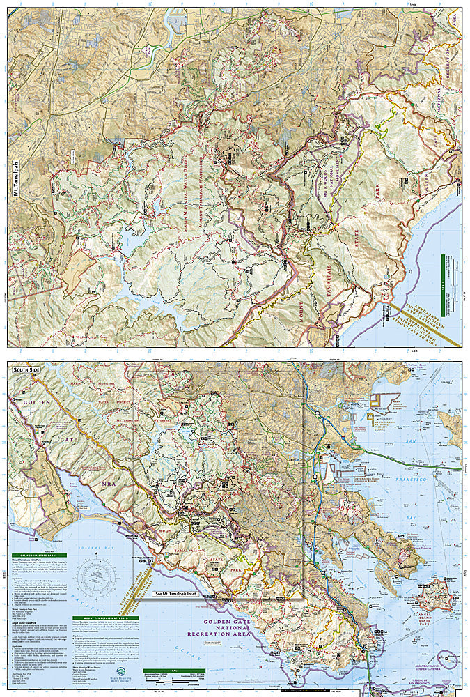
National Geographic Trails Illustrated Mount Tamalpais & Point Reyes Map #266 — waterproof, tear-resistant. Coverage of Mount Tamalpais State Park, Muir Woods, Point Reyes National Seashore, and surrounding Marin County open space in California. GPS-compatible.
The National Geographic Trails Illustrated Mount Tamalpais & Point Reyes Map covers Marin County's premier outdoor recreation areas — Mount Tamalpais State Park, Muir Woods National Monument, Point Reyes National Seashore, and surrounding open space preserves. Hiking and biking trails, beaches, backcountry campsites, and GPS coordinates are mapped in detail.
Key specs
- SKU: NGTI266
- Map number: 266
- Coverage: Mount Tamalpais & Point Reyes, Marin County, California
- Material: Waterproof, tear-resistant paper
- Features: Trails, Muir Woods, Point Reyes beaches, backcountry campsites, bike routes, GPS coordinates
Why it works
Mount Tamalpais and Point Reyes together form one of the most extensive trail networks accessible from San Francisco — a single map covering both areas is far more practical than managing separate maps for each park. Point Reyes's complex trail network, multiple beaches, and backcountry campsites require detailed mapping for planning overnight trips. Waterproof construction survives the coastal fog and rain common in Marin County year-round.
Ideal for
Hikers, mountain bikers, backpackers, and nature lovers exploring Mount Tamalpais, Muir Woods, and Point Reyes National Seashore in Marin County. See also NGTI265 (Boston Harbor Islands) for other coastal national recreation area coverage.
Share