National Geographic
National Geographic Trails Illustrated CA Merced Tuolumne Rivers Map 808
National Geographic Trails Illustrated CA Merced Tuolumne Rivers Map 808
Couldn't load pickup availability
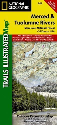
National Geographic Trails Illustrated topo map of the Merced and Tuolumne Rivers, California — waterproof, tear-resistant, GPS-compatible.
National Geographic Trails Illustrated Map 808 covers the Merced and Tuolumne Rivers corridor in California's Sierra Nevada. Detailed topographic contours, trails, campsites, river access points, and points of interest printed on waterproof, tear-resistant paper. GPS-compatible with UTM grid lines.
Key specs:
- Map number: 808
- Publisher: National Geographic Trails Illustrated
- Region: Merced and Tuolumne Rivers, California
- Material: Waterproof, tear-resistant paper
- GPS-compatible with UTM grid lines
- Coverage: Trails, campsites, river access points, topographic contours, and points of interest
- Condition: Brand new
Why it works:
Trails Illustrated maps are the standard reference for Sierra Nevada recreation — more detailed and recreation-focused than standard USGS quads, printed on waterproof paper that survives river crossings and hard use. Essential for rafters, kayakers, hikers, and backpackers navigating the Merced and Tuolumne corridors.
Ideal for: Rafters, kayakers, hikers, backpackers, and anglers exploring the Merced and Tuolumne Rivers in California's Sierra Nevada who need a durable, detailed trail and river map.
Share