National Geographic
Crystal Basin, Silver Fork: Map #806
Crystal Basin, Silver Fork: Map #806
Couldn't load pickup availability
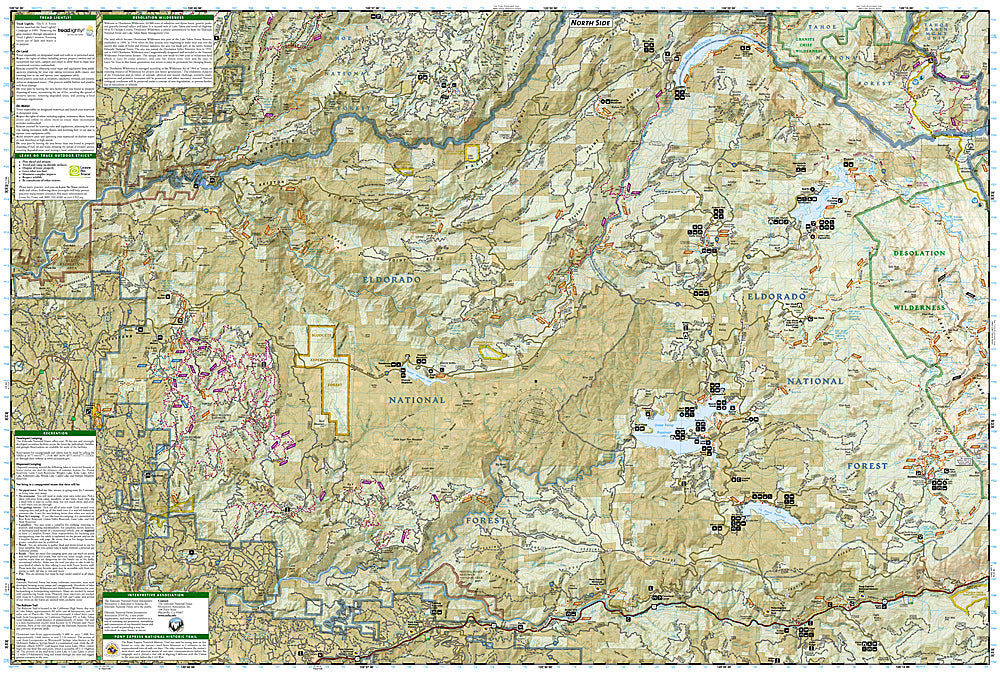
National Geographic Trails Illustrated Crystal Basin & Silver Fork Map #806 — waterproof, tear-resistant. Coverage of the Crystal Basin Recreation Area, Eldorado National Forest, and surrounding Sierra Nevada terrain west of Lake Tahoe in California. GPS-compatible.
The National Geographic Trails Illustrated Crystal Basin & Silver Fork Map covers the Crystal Basin Recreation Area in the Eldorado National Forest — Union Valley Reservoir, Loon Lake, Ice House Reservoir, and surrounding granite and pine forest terrain west of Lake Tahoe. Trails, OHV routes, campgrounds, fishing access, boat ramps, and GPS coordinates are mapped in detail.
Key specs
- SKU: NGTI806
- Map number: 806
- Coverage: Crystal Basin Recreation Area, Eldorado National Forest, California
- Material: Waterproof, tear-resistant paper
- Features: Trails, OHV routes, reservoirs, campgrounds, fishing access, boat ramps, GPS coordinates
Why it works
The Crystal Basin's network of reservoirs, campgrounds, and OHV trails is one of the most popular recreation areas accessible from Sacramento — a map covering all three reservoirs with campground, boat ramp, and trail detail is essential for visitors planning multi-day trips in the area. The OHV trail network requires detailed mapping to navigate the interconnected routes efficiently. Waterproof construction survives the Sierra Nevada's afternoon thunderstorms and the variable weather common in the foothills.
Ideal for
Campers, anglers, OHV riders, and outdoor enthusiasts exploring the Crystal Basin Recreation Area and Eldorado National Forest west of Lake Tahoe. See also NGTI802 (Desolation & Granite Chief Wilderness) for adjacent high-country coverage.
Share