National Geographic
Channel Islands National Park: Map #252
Channel Islands National Park: Map #252
Couldn't load pickup availability
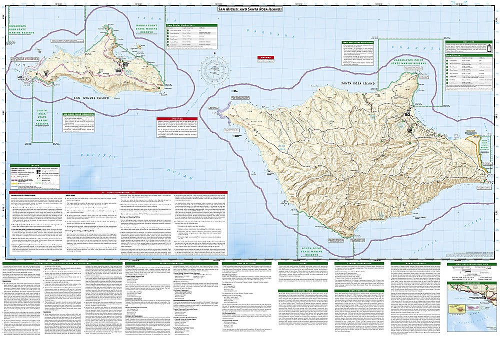
National Geographic Trails Illustrated Channel Islands National Park Map #252 — waterproof, tear-resistant. Coverage of all five Channel Islands — Anacapa, Santa Cruz, Santa Rosa, San Miguel, and Santa Barbara — and surrounding marine protected areas off the California coast. GPS-compatible.
The National Geographic Trails Illustrated Channel Islands National Park Map covers all five islands of the national park off the Southern California coast — Anacapa, Santa Cruz, Santa Rosa, San Miguel, and Santa Barbara. Island trails, sea cave locations, campgrounds, boat landing sites, marine protected area boundaries, and GPS coordinates are mapped in detail.
Key specs
- SKU: NGTI252
- Map number: 252
- Coverage: Channel Islands National Park (all 5 islands), California
- Material: Waterproof, tear-resistant paper
- Features: Island trails, sea caves, campgrounds, boat landings, marine protected areas, GPS coordinates
Why it works
The Channel Islands are accessible only by boat or plane, and each island has a distinct trail network and landing site situation requiring accurate mapping for safe visitor planning. Santa Cruz Island's sea caves are world-class kayaking destinations requiring detailed cave location and access point mapping. Waterproof construction is essential in the marine environment where maps are constantly exposed to salt spray and ocean conditions.
Ideal for
Sea kayakers, hikers, wildlife watchers, and campers exploring the Channel Islands National Park's five islands off the Southern California coast.
Share