National Geographic
Breckenridge Local Trails: Map #606
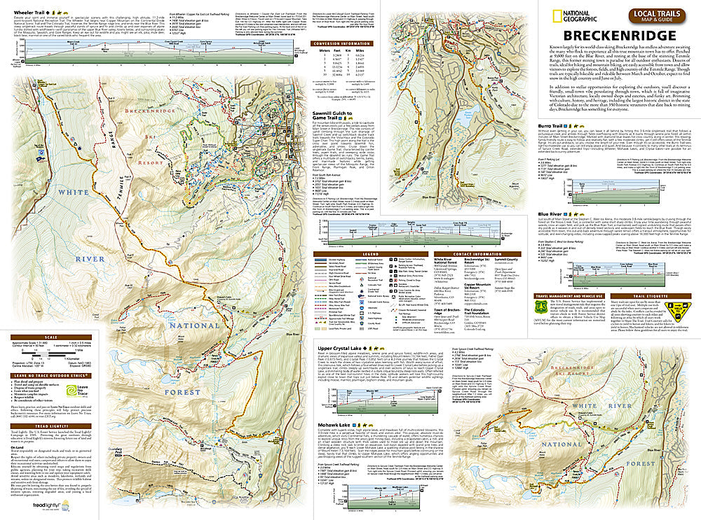
Breckenridge Local Trails: Map #606
Couldn't load pickup availability
National Geographic Trails Illustrated Breckenridge Local Trails Map #606 — waterproof, tear-resistant. Detailed coverage of the Breckenridge local trail network for hiking, mountain biking, and year-round recreation in Colorado. GPS-compatible.
The National Geographic Trails Illustrated Breckenridge Local Trails Map covers the full trail network surrounding Breckenridge — the Breckenridge Ski Resort summer trails, Gold Run Nordic Center, Blue River corridor, and surrounding Summit County singletrack. Trails, difficulty ratings, town access points, winter recreation routes, and GPS coordinates are mapped in detail.
Key specs
- SKU: NGTI606
- Map number: 606
- Coverage: Breckenridge local trail network, Summit County, Colorado
- Material: Waterproof, tear-resistant paper
- Features: Trails, mountain biking routes, difficulty ratings, town access, winter routes, GPS coordinates
Why it works
Breckenridge's trail network connects directly from town to the surrounding national forest, with the ski resort's summer lift-accessed trails and the surrounding singletrack offering a complex network that benefits from detailed local mapping. The Gold Run Nordic Center and the Blue River corridor add significant winter and summer recreation coverage. Waterproof construction survives Summit County's afternoon thunderstorms and the variable weather common at Breckenridge's high elevation.
Ideal for
Mountain bikers, hikers, locals, and visitors exploring the Breckenridge local trail network in Summit County, Colorado. See also NGTI109 (Breckenridge & Tennessee Pass) for broader regional coverage.
Share