National Geographic
Mazatzal & Pine Mountain Wilderness: Map #850
Mazatzal & Pine Mountain Wilderness: Map #850
Couldn't load pickup availability
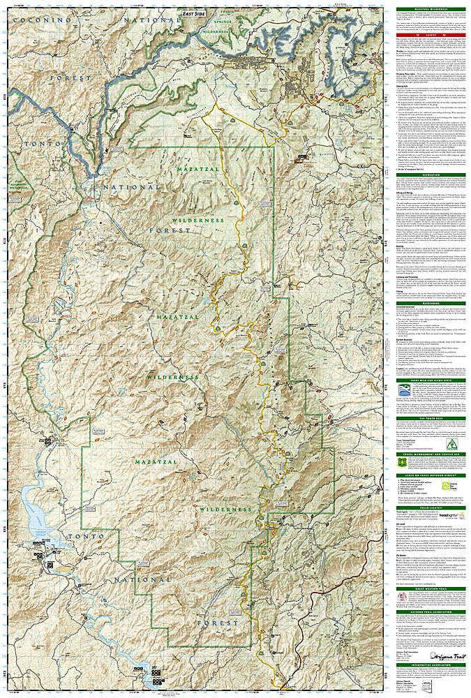
National Geographic Trails Illustrated Mazatzal & Pine Mountain Wilderness Map #850 — waterproof, tear-resistant. Coverage of the Mazatzal Wilderness, Pine Mountain Wilderness, Arizona Trail corridor, and surrounding Tonto National Forest in central Arizona. GPS-compatible.
The National Geographic Trails Illustrated Mazatzal & Pine Mountain Wilderness Map covers the rugged Mazatzal Mountains and Pine Mountain Wilderness in central Arizona's Tonto National Forest — the Arizona Trail corridor, Verde River canyon terrain, remote wilderness trails, and equestrian routes. Trails, wilderness boundaries, water sources, trailheads, and GPS coordinates are mapped in detail.
Key specs
- SKU: NGTI850
- Map number: 850
- Coverage: Mazatzal & Pine Mountain Wilderness, Tonto National Forest, Arizona
- Material: Waterproof, tear-resistant paper
- Features: Trails, Arizona Trail, Mazatzal & Pine Mountain Wilderness, water sources, equestrian routes, GPS coordinates
Why it works
The Mazatzal Wilderness is one of Arizona's largest and most remote wilderness areas, with the Arizona Trail traversing its length and the Verde River forming its western boundary — accurate water source and trail mapping is essential for safe travel in this demanding desert mountain terrain. The Pine Mountain Wilderness's compact but rugged terrain requires detailed topographic mapping for navigation. Waterproof construction survives Arizona's monsoon season thunderstorms and the variable weather common in the Mazatzal Mountains.
Ideal for
Backpackers, equestrians, Arizona Trail hikers, and solitude seekers exploring the Mazatzal and Pine Mountain Wilderness areas in central Arizona. See also NGTI857 (Apache Creek & Juniper Mesa) for adjacent coverage to the northwest.
Share