National Geographic
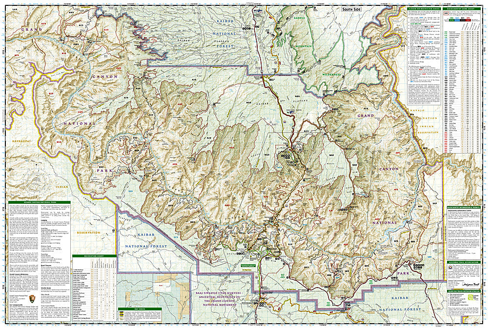
Grand Canyon National Park East: Map #262
Grand Canyon National Park East: Map #262
Couldn't load pickup availability
National Geographic Trails Illustrated Grand Canyon National Park East Map #262 — waterproof, tear-resistant. Coverage of the eastern Grand Canyon including the Desert View area, Nankoweap Trail, North Rim eastern section, and remote backcountry routes in Arizona. GPS-compatible.
The National Geographic Trails Illustrated Grand Canyon National Park East Map covers the eastern section of the Grand Canyon — the Desert View Drive, Nankoweap Trail, Cape Royal on the North Rim, and the remote eastern backcountry. Trails, backcountry campsites, water sources, and GPS coordinates are mapped in detail.
Key specs
- SKU: NGTI262
- Map number: 262
- Coverage: Grand Canyon National Park East, Arizona
- Material: Waterproof, tear-resistant paper
- Features: Trails, Desert View Drive, Nankoweap Trail, Cape Royal, backcountry campsites, water sources, GPS coordinates
Why it works
The eastern Grand Canyon's Nankoweap Trail is one of the most remote and challenging routes in the park, requiring detailed water source and campsite mapping for safe multi-day backcountry travel. The Desert View area and Cape Royal on the North Rim offer spectacular viewpoints that require accurate access road detail. Waterproof construction survives the Grand Canyon's extreme heat and the occasional flash floods that can affect canyon trails.
Ideal for
Experienced backpackers, hikers, and solitude seekers exploring the eastern Grand Canyon's remote trails and Desert View area. See also NGTI261 (Grand Canyon, Bright Angel) for the central corridor and NGTI263 (Grand Canyon West) for the western section.
Share