National Geographic
Grand Canyon National Park West: Map #263
Grand Canyon National Park West: Map #263
Couldn't load pickup availability
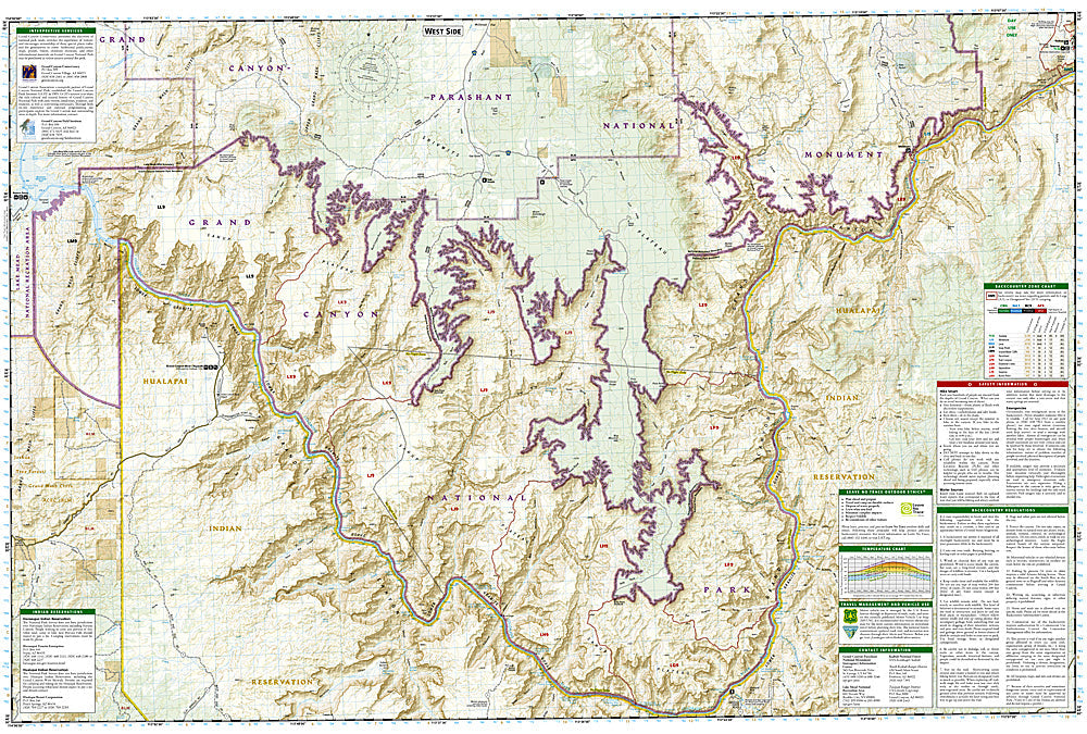
National Geographic Trails Illustrated Grand Canyon National Park West Map #263 — waterproof, tear-resistant. Coverage of the western Grand Canyon including the Hermit Trail, Havasupai Reservation boundary, and remote South Rim trails in Arizona. GPS-compatible.
The National Geographic Trails Illustrated Grand Canyon National Park West Map covers the western section of Grand Canyon National Park — the Hermit Trail, Boucher Trail, Havasupai Reservation boundary, and the remote western South Rim trails. Trails, backcountry campsites, water sources, and GPS coordinates are mapped in detail.
Key specs
- SKU: NGTI263
- Map number: 263
- Coverage: Grand Canyon National Park West, Arizona
- Material: Waterproof, tear-resistant paper
- Features: Trails, Hermit Trail, Boucher Trail, Havasupai boundary, backcountry campsites, water sources, GPS coordinates
Why it works
The western Grand Canyon's non-corridor trails (Hermit, Boucher, Tonto) are significantly more remote and challenging than the Bright Angel and South Kaibab corridors — accurate water source and campsite mapping is essential for safe backcountry travel in this demanding desert environment. The Havasupai Reservation boundary detail is important for visitors planning trips to Havasu Falls. Waterproof construction survives the Grand Canyon's extreme heat and the occasional flash floods that can affect canyon trails.
Ideal for
Experienced backpackers and hikers exploring the western Grand Canyon's non-corridor trails and remote South Rim terrain. See also NGTI261 (Grand Canyon, Bright Angel) for the central corridor and NGTI262 (Grand Canyon East) for the eastern section.
Share