National Geographic
Grand Canyon, Bright Angel: Map #261
Grand Canyon, Bright Angel: Map #261
Couldn't load pickup availability
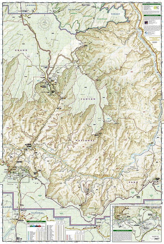
National Geographic Trails Illustrated Grand Canyon Bright Angel Map #261 — waterproof, tear-resistant. Coverage of the Grand Canyon's central corridor including the Bright Angel Trail, South Kaibab Trail, North Kaibab Trail, Phantom Ranch, and the inner canyon in Arizona. GPS-compatible.
The National Geographic Trails Illustrated Grand Canyon Bright Angel Map covers the Grand Canyon's central corridor — the Bright Angel Trail, South Kaibab Trail, North Kaibab Trail, Phantom Ranch, Ribbon Falls, and the inner canyon terrain. Trails, campgrounds, water stations, emergency phones, and GPS coordinates are mapped in detail.
Key specs
- SKU: NGTI261
- Map number: 261
- Coverage: Grand Canyon central corridor (Bright Angel, South & North Kaibab), Arizona
- Material: Waterproof, tear-resistant paper
- Features: Bright Angel Trail, South & North Kaibab Trails, Phantom Ranch, water stations, campgrounds, GPS coordinates
Why it works
The Bright Angel and South Kaibab Trails are the most heavily used backcountry routes in the US national park system, and the rim-to-river elevation change of over 4,700 feet requires detailed water station and rest house location mapping for safe descent and ascent. Phantom Ranch's reservation system and the corridor campgrounds' permit zones require accurate location detail for planning overnight trips. Waterproof construction survives the Grand Canyon's extreme heat and the occasional flash floods that can affect the Bright Angel Trail's creek crossings.
Ideal for
Hikers, backpackers, and canyon explorers navigating the Grand Canyon's corridor trails between the South Rim, Phantom Ranch, and North Rim. See also NGTI262 (Grand Canyon East) and NGTI263 (Grand Canyon West) for adjacent coverage.
Share