National Geographic
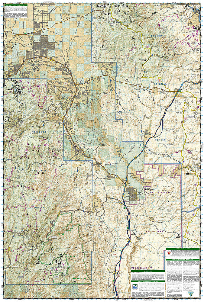
Bradshaw Mountains, Prescott: Map #858
Bradshaw Mountains, Prescott: Map #858
Couldn't load pickup availability
National Geographic Trails Illustrated Bradshaw Mountains & Prescott Map #858 — waterproof, tear-resistant. Coverage of the Bradshaw Mountains, Prescott National Forest, and surrounding terrain including historic mining districts near Prescott, Arizona. GPS-compatible.
The National Geographic Trails Illustrated Bradshaw Mountains & Prescott Map covers the Bradshaw Mountains and Prescott National Forest — the historic mining districts, pine forest trails, OHV routes, and panoramic ridge terrain surrounding Prescott. Trails, OHV routes, historical sites, campgrounds, and GPS coordinates are mapped in detail.
Key specs
- SKU: NGTI858
- Map number: 858
- Coverage: Bradshaw Mountains & Prescott National Forest, Arizona
- Material: Waterproof, tear-resistant paper
- Features: Trails, OHV routes, historic mining sites, Prescott NF, campgrounds, GPS coordinates
Why it works
The Bradshaw Mountains' network of historic mining roads and OHV trails requires detailed mapping to navigate the complex forest road system efficiently. The area's historic mining districts add significant cultural interest that benefits from accurate site location detail. Waterproof construction survives Arizona's monsoon season thunderstorms and the variable weather common in the Prescott area's mile-high elevation.
Ideal for
OHV riders, hikers, history enthusiasts, and outdoor explorers visiting the Bradshaw Mountains and Prescott National Forest near Prescott, Arizona. See also NGTI857 (Apache Creek, Juniper Mesa) for adjacent coverage to the north.
Share