National Geographic
Prince William Sound West: Map #761
Prince William Sound West: Map #761
Couldn't load pickup availability
National Geographic Trails Illustrated Prince William Sound West Map #761 — waterproof, tear-resistant. Coverage of the western Prince William Sound including fjords, glaciers, islands, kayaking routes, and public use cabins in coastal Alaska. GPS-compatible.
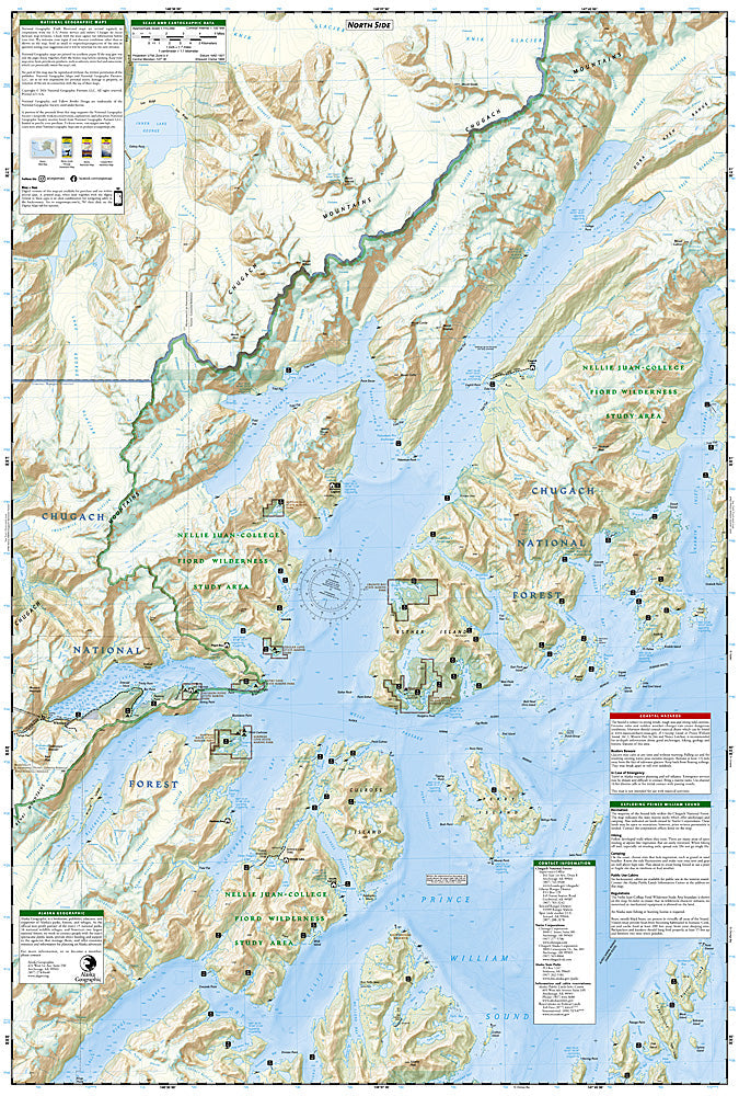
The National Geographic Trails Illustrated Prince William Sound West Map covers the western portion of Prince William Sound in coastal Alaska — the fjords, glaciers, islands, sheltered coves, and kayaking routes accessible from Whittier and Valdez. Kayaking routes, public use cabins, campsite locations, and GPS coordinates are mapped in detail.
Key specs
- SKU: NGTI761
- Map number: 761
- Coverage: Prince William Sound West, Alaska
- Material: Waterproof, tear-resistant paper
- Features: Kayaking routes, fjords, glaciers, public use cabins, campsites, GPS coordinates
Why it works
Prince William Sound's complex network of fjords, islands, and glaciers makes accurate marine and coastal mapping essential for kayakers and boaters navigating the sound's sheltered waterways. The public use cabin locations and campsite detail are critical for planning multi-day paddling trips in an area where weather can change rapidly and shelter is essential. Waterproof construction is absolutely critical in Alaska's coastal environment where rain, salt spray, and sea conditions constantly expose maps to moisture.
Ideal for
Sea kayakers, boaters, and adventurers exploring the fjords, glaciers, and islands of western Prince William Sound in Alaska. See also NGTI764 (Anchorage, Chugach State Park) for adjacent coverage.
Share