National Geographic
Kenai Fjords National Park: Map #231
Kenai Fjords National Park: Map #231
Couldn't load pickup availability
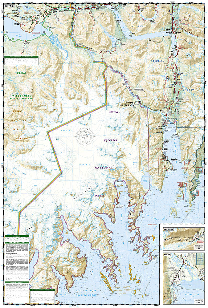
National Geographic Trails Illustrated Kenai Fjords National Park Map #231 — waterproof, tear-resistant. Coverage of Kenai Fjords National Park including Exit Glacier, the Harding Icefield Trail, and coastal kayaking routes on the Kenai Peninsula, Alaska. GPS-compatible.
The National Geographic Trails Illustrated Kenai Fjords National Park Map covers the full national park on the Kenai Peninsula — Exit Glacier, the Harding Icefield Trail, the park's fjord coastline, and surrounding wilderness terrain. Trails, Harding Icefield route, coastal kayaking routes, and GPS coordinates are mapped in detail.
Key specs
- SKU: NGTI231
- Map number: 231
- Coverage: Kenai Fjords National Park, Alaska
- Material: Waterproof, tear-resistant paper
- Features: Exit Glacier trails, Harding Icefield route, coastal kayaking routes, GPS coordinates
Why it works
The Harding Icefield Trail is one of Alaska's most spectacular day hikes, gaining 3,000 feet to reach the vast icefield above Exit Glacier — accurate trail and glacier edge mapping is essential for safe navigation on this demanding route. The park's fjord coastline is accessible only by boat or kayak, making detailed coastal route and landing site mapping critical for sea kayakers. Waterproof construction is essential in Alaska's wet coastal climate where rain is nearly constant.
Ideal for
Hikers, sea kayakers, and glacier viewers exploring Kenai Fjords National Park's Exit Glacier, Harding Icefield, and fjord coastline in Alaska. See also NGTI764 (Anchorage & Chugach State Park) for adjacent coverage to the north.
Share