National Geographic
Katmai National Park: Map #248
Katmai National Park: Map #248
Couldn't load pickup availability
National Geographic Trails Illustrated Katmai National Park Map #248 — waterproof, tear-resistant. Coverage of Katmai National Park & Preserve including the Valley of Ten Thousand Smokes, Brooks Falls, and surrounding wilderness in Alaska. GPS-compatible.
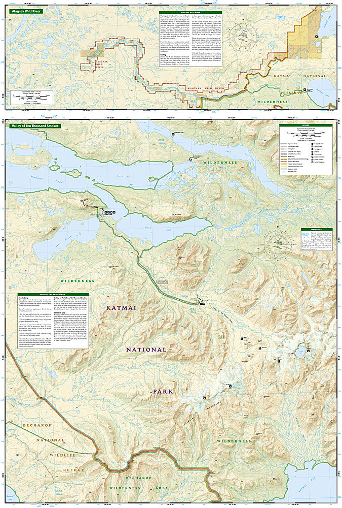
The National Geographic Trails Illustrated Katmai National Park Map covers the full national park and preserve on the Alaska Peninsula — the Valley of Ten Thousand Smokes (site of the 1912 Novarupta eruption), Brooks Falls (world-famous brown bear viewing), Brooks Camp, and surrounding wilderness terrain. Trails, bear viewing areas, backcountry routes, campgrounds, and GPS coordinates are mapped in detail.
Key specs
- SKU: NGTI248
- Map number: 248
- Coverage: Katmai National Park & Preserve, Alaska
- Material: Waterproof, tear-resistant paper
- Features: Valley of Ten Thousand Smokes, Brooks Falls, bear viewing areas, backcountry routes, campgrounds, GPS coordinates
Why it works
Katmai is one of the most remote national parks in the US, accessible only by floatplane or boat — accurate terrain and route mapping is essential for backcountry travel in a park where brown bears are abundant and trails are minimal. The Valley of Ten Thousand Smokes' volcanic terrain requires detailed topographic mapping for safe navigation. Waterproof construction is essential in Alaska's wet coastal climate where rain is nearly constant.
Ideal for
Wildlife watchers, backpackers, and adventurers exploring Katmai National Park's bear viewing areas, Valley of Ten Thousand Smokes, and remote wilderness in Alaska.
Share