National Geographic
Chilkoot Trail, Klondike Gold Rush: Map #254
Chilkoot Trail, Klondike Gold Rush: Map #254
Couldn't load pickup availability
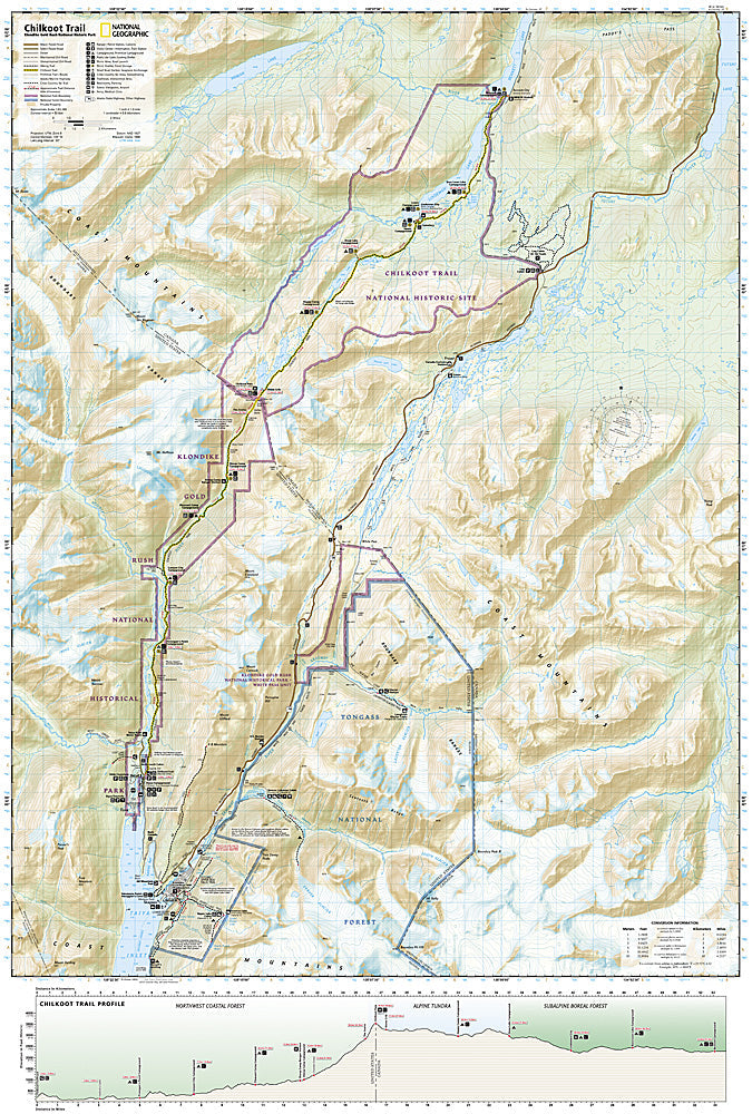
National Geographic Trails Illustrated Chilkoot Trail & Klondike Gold Rush Map #254 — waterproof, tear-resistant. Coverage of the historic Chilkoot Trail from Dyea, Alaska to Bennett, British Columbia, and surrounding Klondike Gold Rush National Historical Park terrain. GPS-compatible.
The National Geographic Trails Illustrated Chilkoot Trail Map covers the complete 33-mile Chilkoot Trail — the historic route used by 100,000 gold seekers during the 1897-98 Klondike Gold Rush from Dyea, Alaska over Chilkoot Pass to Bennett, British Columbia. Trail route, historical sites, campgrounds, ranger stations, and GPS coordinates are mapped in detail.
Key specs
- SKU: NGTI254
- Map number: 254
- Coverage: Chilkoot Trail, Klondike Gold Rush NHP (AK/BC)
- Material: Waterproof, tear-resistant paper
- Features: Complete trail route, historical sites, campgrounds, ranger stations, Chilkoot Pass, GPS coordinates
Why it works
The Chilkoot Trail is one of North America's most historically significant hiking routes, and the combination of historical artifact sites and challenging subarctic terrain requires a map covering both the cultural and navigational aspects of the journey. The trail crosses the US-Canada border at Chilkoot Pass, requiring accurate border crossing and permit zone detail. Waterproof construction is essential in the Southeast Alaska and British Columbia coastal climate where rain is frequent and the trail environment is consistently wet.
Ideal for
History enthusiasts, backpackers, and adventurers hiking the Chilkoot Trail through Klondike Gold Rush National Historical Park in Alaska and British Columbia.
Share