National Geographic
PCT California, San Gabriel & San Bernardino: Map #1011
PCT California, San Gabriel & San Bernardino: Map #1011
Couldn't load pickup availability
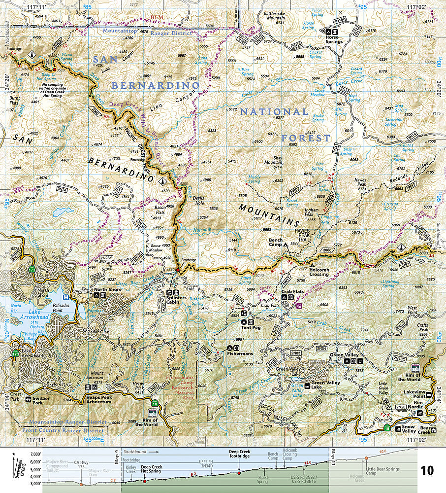
National Geographic Trails Illustrated PCT California San Gabriel & San Bernardino Map #1011 — waterproof, tear-resistant. Coverage of the Pacific Crest Trail through the San Gabriel and San Bernardino Mountains from the Mojave Desert to Big Bear, California. GPS-compatible.
The National Geographic Trails Illustrated PCT California San Gabriel & San Bernardino Map covers the PCT through Southern California's mountain ranges — from the Mojave Desert through the San Gabriel Mountains (Wrightwood, Mount Baden-Powell) to the San Bernardino Mountains (Big Bear Lake). Trail route, water sources, resupply points, road crossings, and GPS coordinates are mapped in detail.
Key specs
- SKU: NGTI1011
- Map number: 1011
- Coverage: PCT through San Gabriel & San Bernardino Mountains, California
- Material: Waterproof, tear-resistant paper
- Features: PCT route, water sources, resupply points, road crossings, elevation profiles, GPS coordinates
Why it works
The Southern California PCT section is the most water-critical stretch of the entire trail — water sources can be 20+ miles apart in the desert sections, making accurate water cache and natural source mapping essential for safe passage. The climb from the Mojave Desert to the San Gabriel Mountains' pine forests is one of the most dramatic elevation changes on the PCT. Waterproof construction survives the desert heat and the occasional rain that can make trail sections slippery.
Ideal for
PCT thru-hikers, section hikers, and trail angels navigating the San Gabriel and San Bernardino Mountains section of the Pacific Crest Trail. See also NGTI1012 (PCT San Jacinto & Laguna Mountains) for the adjacent southern section.
Share