National Geographic
Colorado Trail South: Map #1201
Colorado Trail South: Map #1201
Couldn't load pickup availability
National Geographic Trails Illustrated Colorado Trail South Map #1201 — waterproof, tear-resistant. Coverage of the southern Colorado Trail from the San Juan Mountains to the Durango terminus, including the Weminuche Wilderness and La Garita Wilderness sections. GPS-compatible.
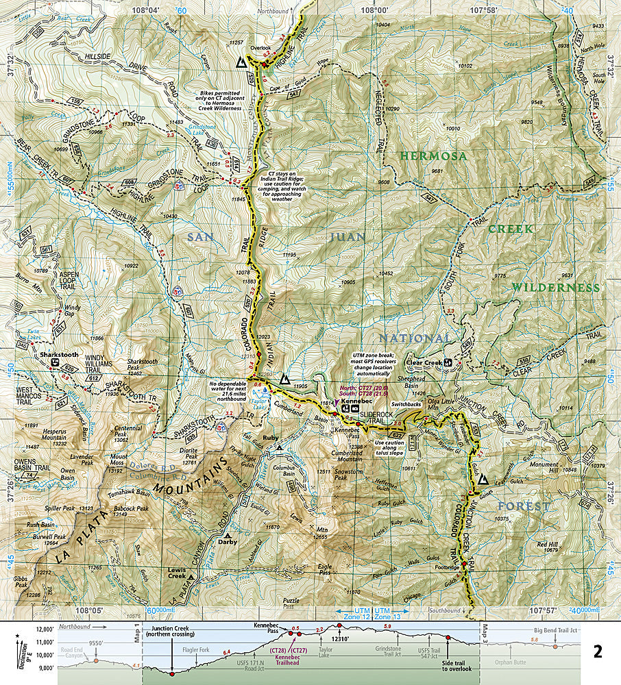
The National Geographic Trails Illustrated Colorado Trail South Map covers the southern section of the Colorado Trail — from the San Juan Mountains through the Weminuche Wilderness and La Garita Wilderness to the Durango terminus at Junction Creek. Trail route, elevation profiles, water sources, resupply points, wilderness boundaries, and GPS coordinates are mapped in detail.
Key specs
- SKU: NGTI1201
- Map number: 1201
- Coverage: Colorado Trail South (San Juans to Durango terminus)
- Material: Waterproof, tear-resistant paper
- Features: CT route, elevation profiles, water sources, resupply points, Weminuche & La Garita Wilderness, GPS coordinates
Why it works
The southern Colorado Trail section through the San Juan Mountains is the most remote and spectacular portion of the entire trail, with the Weminuche Wilderness requiring multi-day commitments and the La Garita Wilderness offering some of the most isolated terrain on the CT. The elevation profiles and water source detail go beyond what standard topographic maps provide for planning this demanding section. Waterproof construction survives the San Juan Mountains' afternoon thunderstorms.
Ideal for
Colorado Trail thru-hikers, section hikers, and backpackers navigating the southern CT through the San Juan Mountains to Durango. See also NGTI1202 (Colorado Trail North) for the northern section.
Share