National Geographic
Colorado Backpack Loops North: Map #1304
Colorado Backpack Loops North: Map #1304
Couldn't load pickup availability
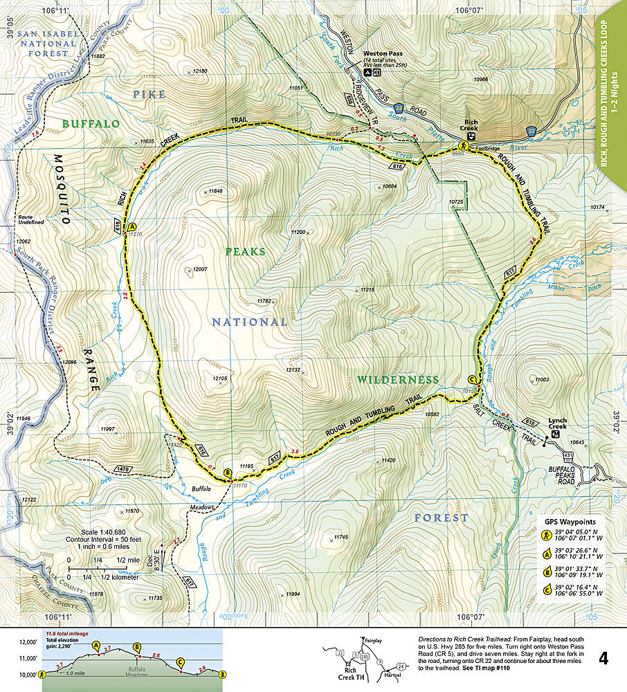
National Geographic Trails Illustrated Colorado Backpack Loops North Map #1304 — waterproof, tear-resistant. Coverage of the best multi-day backpacking loop routes in northern Colorado including the Indian Peaks, Eagles Nest, and Mount Zirkel Wilderness areas. GPS-compatible.
The National Geographic Trails Illustrated Colorado Backpack Loops North Map covers the premier multi-day backpacking loop routes in northern Colorado — the Indian Peaks Wilderness, Eagles Nest Wilderness, Mount Zirkel Wilderness, and surrounding wilderness areas. Loop route overviews, elevation profiles, water sources, campsite locations, and GPS coordinates are mapped in detail.
Key specs
- SKU: NGTI1304
- Map number: 1304
- Coverage: Northern Colorado backpacking loops (Indian Peaks, Eagles Nest, Mount Zirkel)
- Material: Waterproof, tear-resistant paper
- Features: Loop route overviews, elevation profiles, water sources, campsite locations, GPS coordinates
Why it works
Northern Colorado's wilderness areas offer excellent multi-day loop backpacking, but the variety of possible routes and the complex trail networks make a dedicated loop route guide essential for planning efficient itineraries. The elevation profiles and water source detail go beyond what standard topographic maps provide. Waterproof construction survives the afternoon thunderstorms common in Colorado's northern mountain wilderness areas.
Ideal for
Backpackers planning multi-day loop trips in northern Colorado's Indian Peaks, Eagles Nest, and Mount Zirkel Wilderness areas. See also NGTI1305 (Colorado Backpack Loops South) for southern Colorado loop coverage.
Share