National Geographic
Colorado 14ers South: Map #1303
Colorado 14ers South: Map #1303
Couldn't load pickup availability
National Geographic Trails Illustrated Colorado 14ers South Map #1303 — waterproof, tear-resistant. Coverage of the southern Colorado 14ers including the San Juan Mountains, Sangre de Cristo Range, and South Sawatch peaks. GPS-compatible.
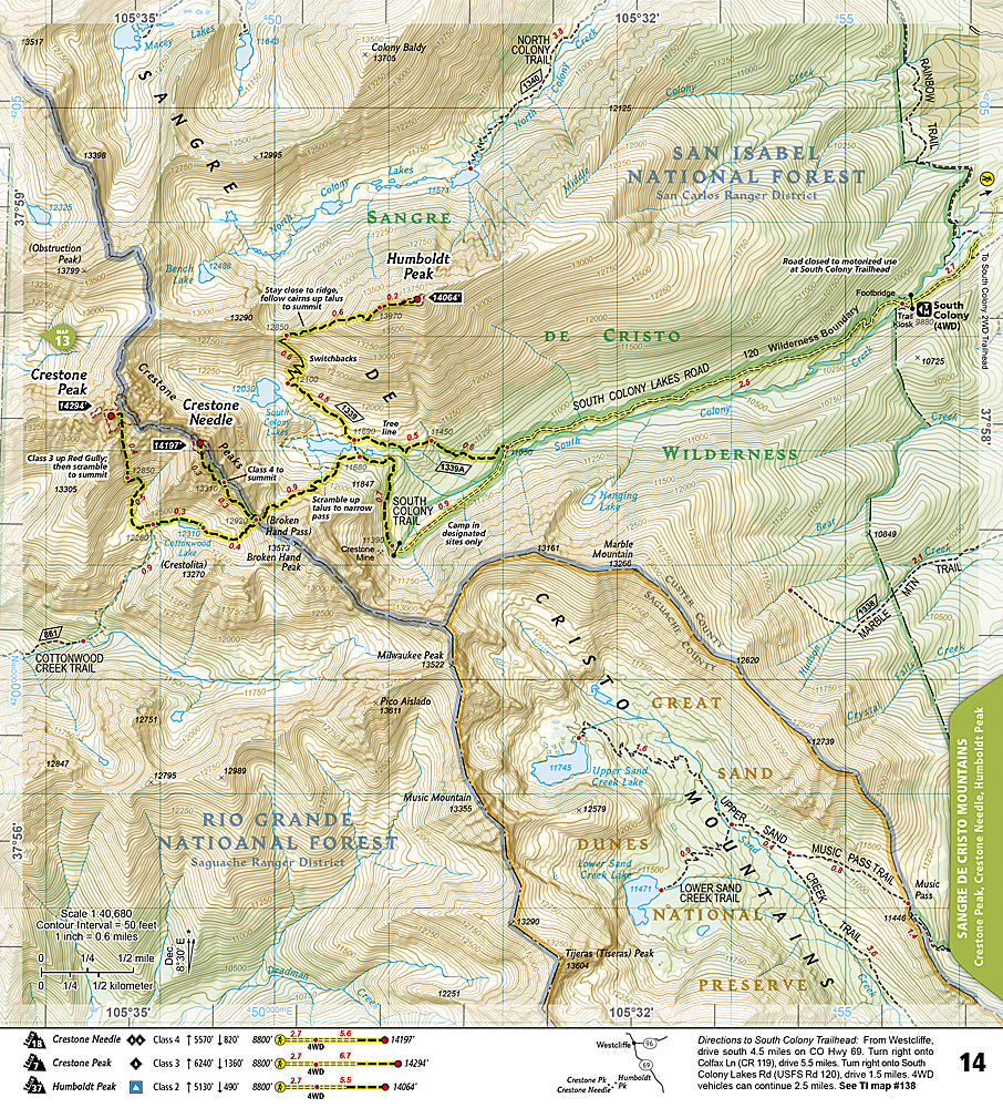
The National Geographic Trails Illustrated Colorado 14ers South Map covers the southern Colorado 14ers — the San Juan Mountains (Uncompahgre, Wetterhorn, Handies, Redcloud, Sunshine, San Luis), Sangre de Cristo Range (Crestone Needle, Crestone Peak, Kit Carson, Humboldt), and South Sawatch (La Plata, Mount Shavano, Tabeguache). Route overviews, trailheads, approach roads, and GPS coordinates are mapped in detail.
Key specs
- SKU: NGTI1303
- Map number: 1303
- Coverage: Southern Colorado 14ers (San Juans, Sangre de Cristos, South Sawatch)
- Material: Waterproof, tear-resistant paper
- Features: 14er route overviews, trailheads, approach roads, GPS coordinates
Why it works
The southern Colorado 14ers are spread across a vast area of the state requiring multiple individual maps to cover at sufficient scale — a dedicated 14ers overview map provides route summaries and trailhead locations for all southern peaks in a single reference sheet. The Crestone group in the Sangre de Cristos is among the most technically challenging 14er terrain in Colorado, making accurate route overview detail especially valuable. Waterproof construction survives the afternoon thunderstorms that are a constant hazard on Colorado's exposed 14er ridgelines.
Ideal for
Peak baggers and mountaineers planning to climb the southern Colorado 14ers. See also NGTI1302 (Colorado 14ers North) for the northern peaks and individual area maps for detailed route navigation.
Share