National Geographic
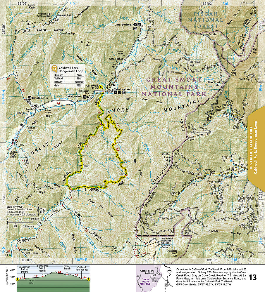
Great Smoky Mountains Day Hikes: Map #1702
Great Smoky Mountains Day Hikes: Map #1702
Couldn't load pickup availability
National Geographic Trails Illustrated Great Smoky Mountains Day Hikes Map #1702 — waterproof, tear-resistant. Dedicated coverage of the best day hikes in Great Smoky Mountains National Park with trail ratings, distances, and waterfall and wildlife highlights. GPS-compatible.
The National Geographic Trails Illustrated Great Smoky Mountains Day Hikes Map provides dedicated coverage of the park's most popular day hiking routes — Alum Cave Trail, Laurel Falls, Chimney Tops, Ramsey Cascades, and more. Trail distances, difficulty ratings, trailhead locations, and GPS coordinates are mapped in detail.
Key specs
- SKU: NGTI1702
- Map number: 1702
- Coverage: Great Smoky Mountains National Park day hike routes, Tennessee & North Carolina
- Material: Waterproof, tear-resistant paper
- Features: Popular day hike routes, difficulty ratings, distances, waterfall locations, trailhead info, GPS coordinates
Why it works
Great Smoky Mountains is the most visited national park in the US, with over 12 million visitors per year — a day hike focused map with difficulty ratings and distances is far more practical for the park's majority of visitors than a full topographic map. The park's dense trail network and the popularity of specific waterfall trails require accurate trailhead and junction detail. Waterproof construction survives the Smokies' frequent rain and the high humidity common in the southern Appalachians year-round.
Ideal for
Park visitors, families, and day hikers exploring Great Smoky Mountains National Park's waterfalls, ridges, and wildlife areas. See also NGTI229 (Great Smoky Mountains National Park) for full topographic coverage.
Share