National Geographic
Dillon Silverthorne Local Trails: Map & Guide
Dillon Silverthorne Local Trails: Map & Guide
Couldn't load pickup availability
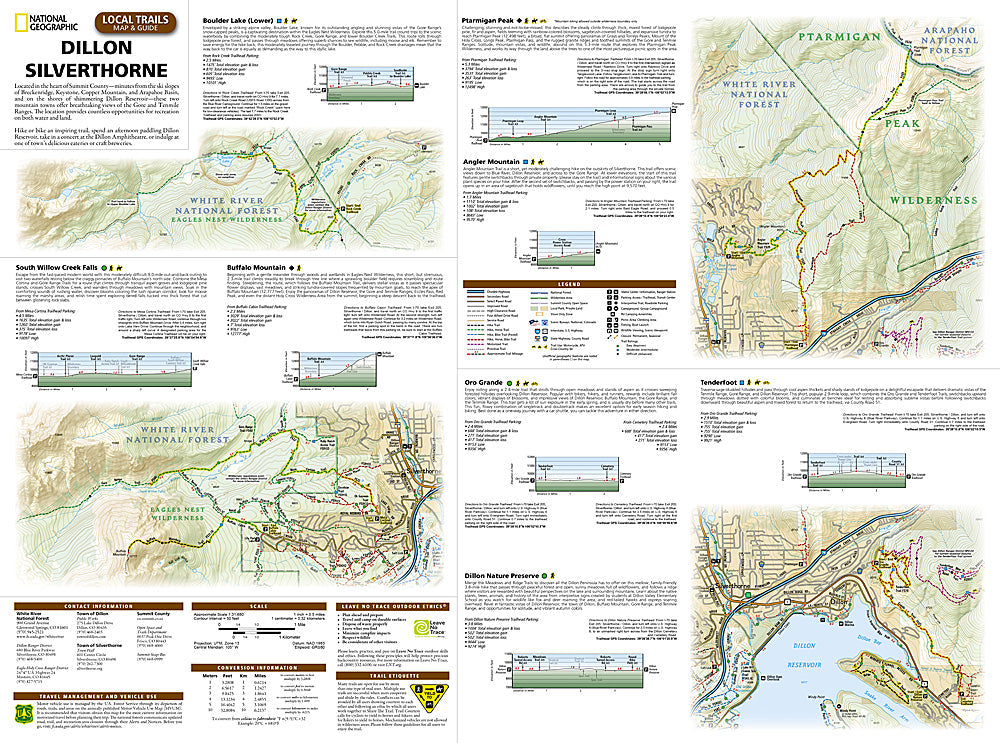
National Geographic Trails Illustrated Dillon & Silverthorne Local Trails Map & Guide — waterproof, tear-resistant. Coverage of the local trail network around Dillon Reservoir and the Blue River in Summit County, Colorado including hiking and biking trails, paved paths, and trailhead access. GPS-compatible.
The National Geographic Trails Illustrated Dillon & Silverthorne Local Trails Map covers the trail network surrounding Dillon Reservoir and the Blue River in Summit County — hiking and mountain biking trails, paved recreation paths, trailheads, and parking areas around Dillon, Silverthorne, and the reservoir shoreline. Trail routes and GPS coordinates are mapped in detail.
Key specs
- SKU: NGTI607
- Coverage: Dillon & Silverthorne local trail network, Summit County, Colorado
- Material: Waterproof, tear-resistant paper
- Features: Hiking and biking trails, paved paths, Dillon Reservoir shoreline, trailheads, parking, GPS coordinates
Why it works
Dillon Reservoir is the centerpiece of Summit County's trail network, with paths connecting Dillon, Silverthorne, Frisco, and Breckenridge around the lake — a local trails map covering the full reservoir loop and connecting trails is essential for visitors navigating the area's multi-use path system. The Blue River corridor adds additional trail coverage north of the reservoir. Waterproof construction survives Summit County's afternoon thunderstorms and the variable weather common at 9,000 feet.
Ideal for
Hikers, cyclists, families, and outdoor enthusiasts exploring the trail network around Dillon Reservoir and Silverthorne in Summit County. See also NGTI108 (Vail, Frisco, Dillon) for broader topographic coverage of the area.
Share