National Geographic
National Geographic Flat Tops Wilderness GMU Bundle
National Geographic Flat Tops Wilderness GMU Bundle
Couldn't load pickup availability
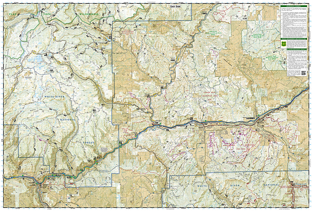
National Geographic Trails Illustrated Flat Tops Wilderness GMU Map Bundle — waterproof, tear-resistant, detailed topography, GMU boundaries, hiking trails, OHV routes, and access points. For hunters, hikers, and anglers in northwest Colorado.
The National Geographic Flat Tops Wilderness GMU Map Bundle includes the Trails Illustrated maps covering the Flat Tops Wilderness and surrounding Game Management Units in northwest Colorado — one of Colorado's premier elk hunting areas, known for its high plateaus, alpine lakes, and abundant wildlife. Detailed topography, GMU boundaries, hiking trails, OHV routes, and access points on waterproof, tear-resistant paper.
Key specs
- SKU: NGTIB220
- Coverage: Flat Tops Wilderness and surrounding GMUs, northwest Colorado
- Material: Waterproof, tear-resistant paper
- Features: Detailed topography, GMU boundaries, hiking trails, OHV routes, access points
- Format: Multi-map bundle
Why it works
The Flat Tops Wilderness and surrounding GMUs cover a large area of northwest Colorado's White River National Forest that requires multiple maps for complete coverage at a useful scale. The GMU boundary detail overlaid on accurate topography is essential for hunters who need to know exactly where they are relative to unit boundaries and wilderness regulations. The OHV route detail is valuable for accessing remote hunting areas. Waterproof construction survives Colorado's high-country weather during hunting season.
Ideal for
Hunters, hikers, backpackers, and anglers exploring the Flat Tops Wilderness and surrounding GMUs in northwest Colorado. See also NGTIB221 (Uncompahgre Plateau GMU Bundle) for additional Colorado GMU coverage.
Share